
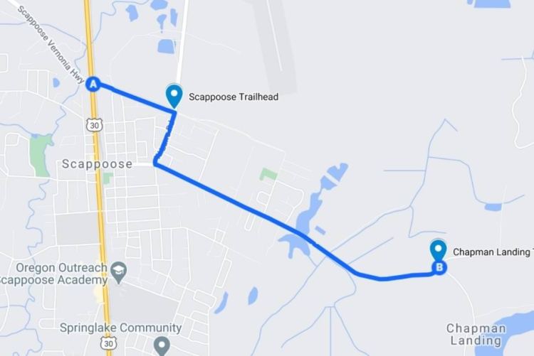
(note – the current name for the Scappoose Trailhead is now “Trtek Trailhead”.)
Most of Columbia County is forested hills aligned with the foothills of the Coast Range to the west. But there’s a portion of the county along the Columbia River, especially around Scappoose, made up of wetland flats aligned with the ecology of the Willamette Valley to the south. Those wetlands can be experienced on the section of the CZ Trail from Scappoose Trailhead to Chapman Landing Trailhead.
Unlike the forested majority of the CZ Trail, here you’ll find open flats and marshes. Rabbits, ground squirrels, and garter snakes are plentiful. Cherry trees and blackberry bushes produce sweet plump fruits in the summer.


Red-spotted Garter Snake 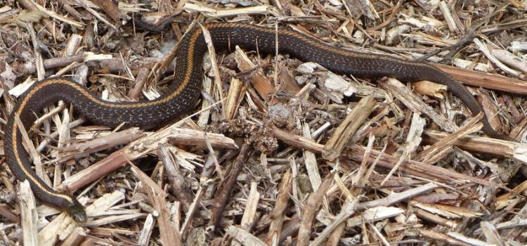
Northwestern Garter Snake 
Red-breasted Sapsucker 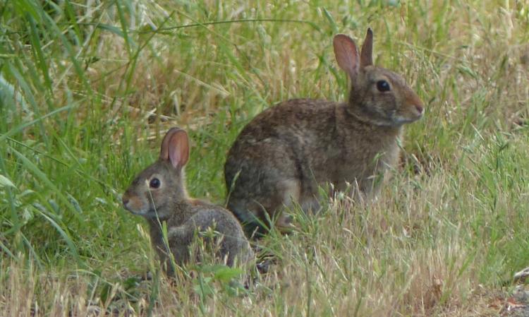
Brush Rabbits
I’ve notice that garter snakes and small mammals are sometimes killed by mowers that keep the grass down on the edges of the trail. Perhaps it would be possible to set the mowers about an inch higher and give these small animals a better chance to hunker down and survive the passing blades? There are also a large number of garter snakes with missing tails, which could be due to mowers but also could be the result of neighborhood outdoor cats which prey on local wildlife.
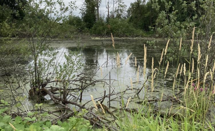
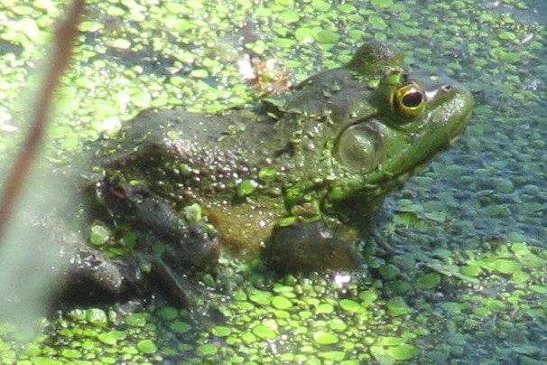
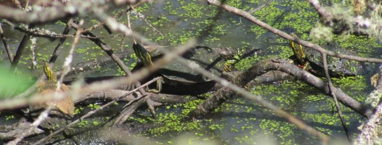
For the first 0.75 miles of the hike you have fields to your left with residential lots to your right, then you hit the real treat of this stretch: the wetlands. Marshes and canals bracket both sides of the trail, full of waterfowl, wading birds, turtles, and aquatic mammals including beaver, nutria, muskrat, and otter.


After a stretch of marsh and another stretch of field, you reach the Chapman Landing Trailhead 1.4 miles into your walk. Pacific treefrogs and long-toed salamanders breed in the small dike next to the lot, while blackberries grow plentifully in the margin.
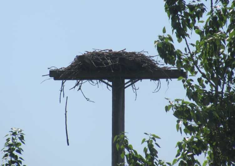
From there it’s half a mile to “Chapman Landing Park”, the endpoint of the CZ Trail which overlooks the Multnomah Slough arm of the Columbia River. An osprey nest is built here, and if you’re lucky you might catch ospreys watching you from above.

Returning to your starting point at Scappoose Trailhead gives you 3.8 miles on the day. You could also go west from Scappoose Trailhead towards Scappoose, but that direction is quite boring for most of the 2.5 miles before you reach Pisgah Trailhead, going through business and residential districts and useful only to add miles for those looking to put up a big number on the day.
Scappoose Trailhead to Chapman Landing at a glance
What: Hiking, bird watching, berry picking
Where: Scappoose Trailhead (45.7611, -122.8697) is on NE Crown Zellerbach Logging Road 0.4 miles east of Hwy 30 in Scappoose, directly east of the intersection with West Lane Road. Chapman Landing Trailhead (45.7505,-122.8442) is on the intersection of Dike Road and E Columbia Road.
Hiking: 3.8 miles to go from Scappoose Trailhead to the Chapman Landing end of the trail and back. Part of the 22-mile long CZ Trail, with another 2.5 miles one-way in the opposite direction to get from the Scappoose Trailhead to Pisgah Trailhead on the west side of Scappoose.
Camping: none
Notable Wildlife: Beaver, Brush Rabbit, woodpeckers, Bald Eagle, Osprey, American Bittern, Green Heron, Virginia Rail, Sora, other wading birds, waterfowl, Western Painted Turtle, garter snakes
Property status: Columbia County Parks
Website: Crown Z Trail official site
Friends of CZ Linear Park Trail

One thought on “CZ Trail: Scappoose to Chapman Landing”