
On occasion we give Rosey a break and take Sophia out for the day. Matt and I got ambitious and decided to take the little girl on a two-leg stretch of the Banks-Vernonia State Trail. Sure it was a big chunk to bite off, sure there were rainstorms forecast all day, but we were up for the challenge.
Right?
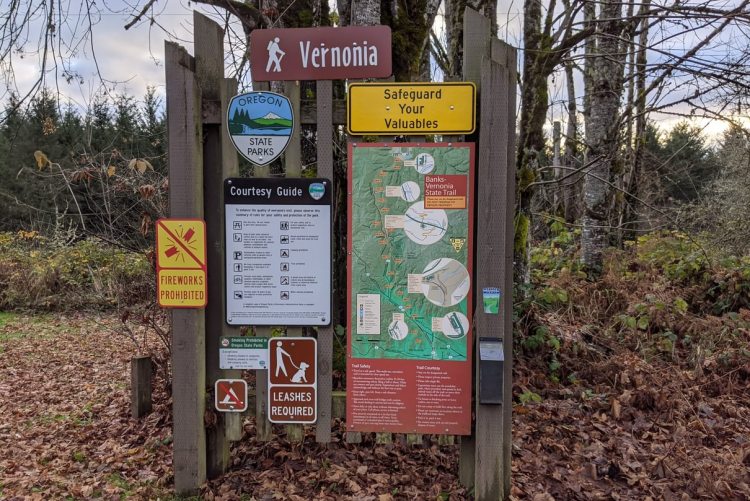
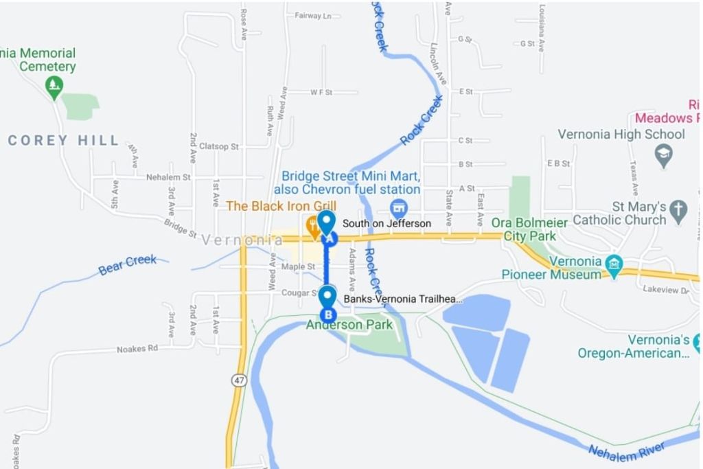
Matt and I met at the Vernonia Trailhead that marks the northernmost end of Banks-Vernonia, a 21 mile paved trail built on the remains of a Burlington Northern timber railway. This trailhead sits adjacent to Anderson Park in central Vernonia and can also be accessed (with an extra mile of walking) from Vernonia Lake.
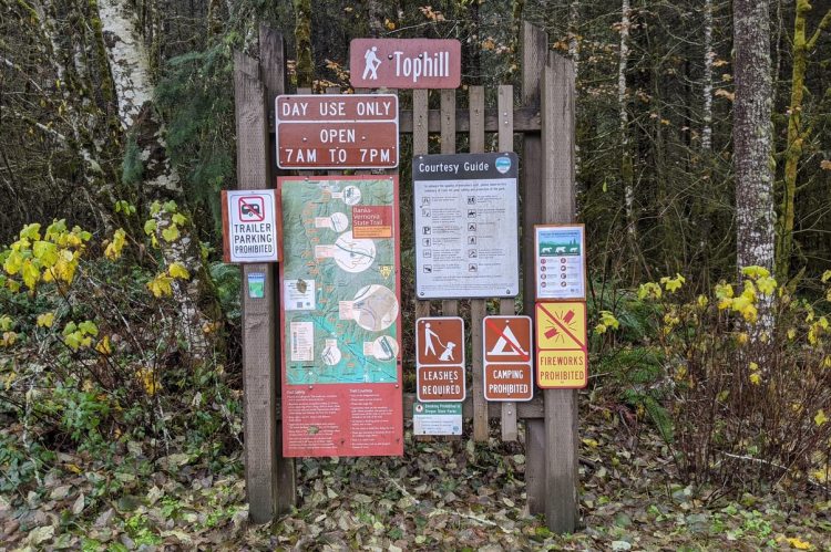
But the three of us weren’t starting in Vernonia today. Instead Matt parked his car, masked up, and jumped in my back seat across from a sleeping Sophia. We headed south to Tophill Trailhead, well across the Washington County border.
Sophia finished off her midday nap while we prepped our gear in the parking lot, which was spacious and had a clean outhouse available. It was past 12:30pm by the time we got going from the Tophill, (half an hour later than we hoped to have started), and we had 8.7 miles ahead of us to get back to Matt’s car.
As always when hiking with a little one, you have to plan for a lot of extra time. We were already cutting it closer than we had wanted to…..
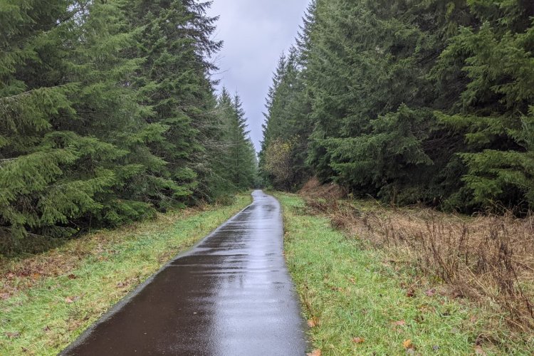
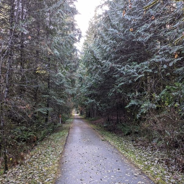
Looking about 200 yards to the south we could see a big 100-foot railway trestle looming over Highway 47. You don’t have to go over that, of course. Instead, the trail crosses the highway and then Beaver Creek, then climbs a couple switchbacks to get to that upper area where the railroad once sat. From there it was a straight shot north through young forest and the occasional clearcut.
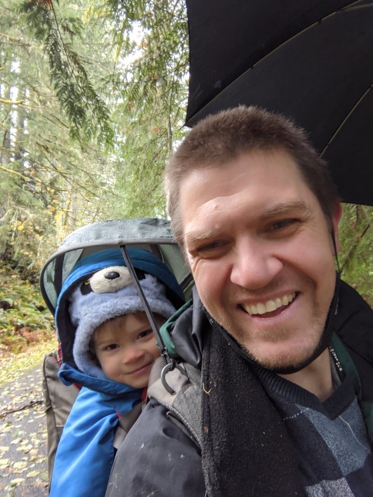
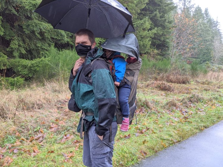
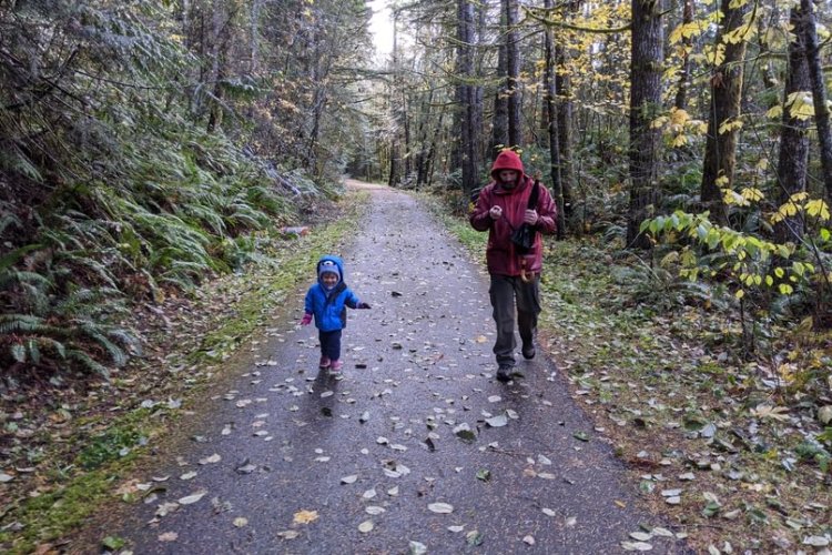
Rain was already falling. Thankfully we were well-prepared, with Sophia protected by a warm layer under a raincoat, sitting under the rainfly of my carrying pack, and me holding an umbrella above it all. She didn’t stay entirely dry but she was more than warm enough, and happy!
With inclement weather, a baby on the back, and no data to collect, Matt and I rushed through the first 1.9 miles at a nice clip. That’s when we hit the Columbia County border, helpfully marked with a humble placard.
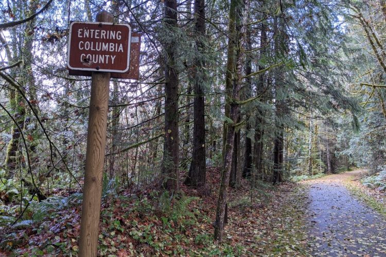
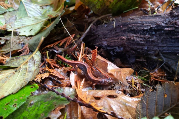
You may know that Matt and I are running a research project to document reptiles and amphibians within the Columbia County borders. As Matt wandered off for a moment, I looked down and saw a hand-sized chunk of wood propped up against the signpost, just barely sticking out into Columbia County territory. I couldn’t bend over easy with Sophia on my back, so I nudged it over with my foot…and a Western Red-backed Salamander was sitting underneath! Our first data of the day just 2 inches across the county line.
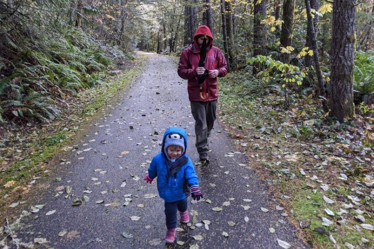
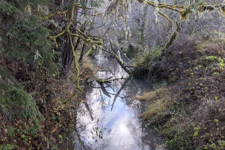
The light rain had died off so we took Sophia out to work her legs. She loved it, hurrying along the trail while Matt and I inspected rocks and underbrush for amphibians. As you can see the forest trends older in this beautiful section.
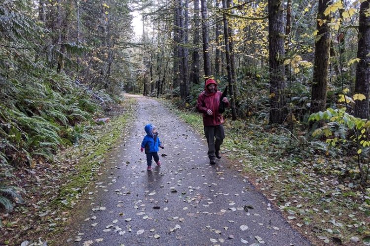
The pace had to slow quite a bit but we were all having fun.
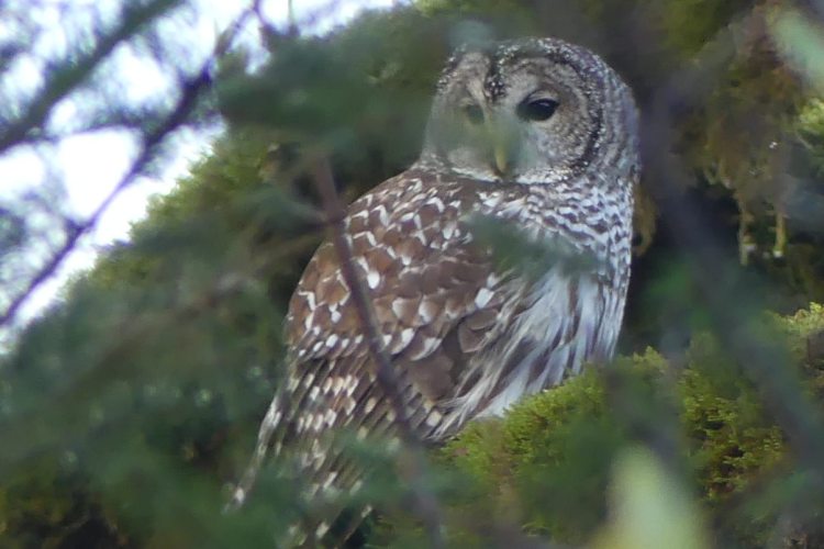
Our next significant wildlife encounter would be up in the trees. Just as we reached the Beaver Creek Trailhead 4.4 miles into the day, a huge Barred Owl flew up from above the outhouse. It settled onto a nearby branch and watched us stare in awe at its magnificence. Perhaps it was just puffed out due to the cold, but it looked as big as a Great Grey.
At the Beaver Creek Trailhead we took a bit of a snack break (well Sophie did at least) and switched the little girl into dry clothes.
Sophia went back in the pack for a while and we continued north. A cute gang of birds fluttered around us, too erratically for a real picture. It took me a while to get a bead on them but I eventually ID’d them as Golden-crowned Kinglets.
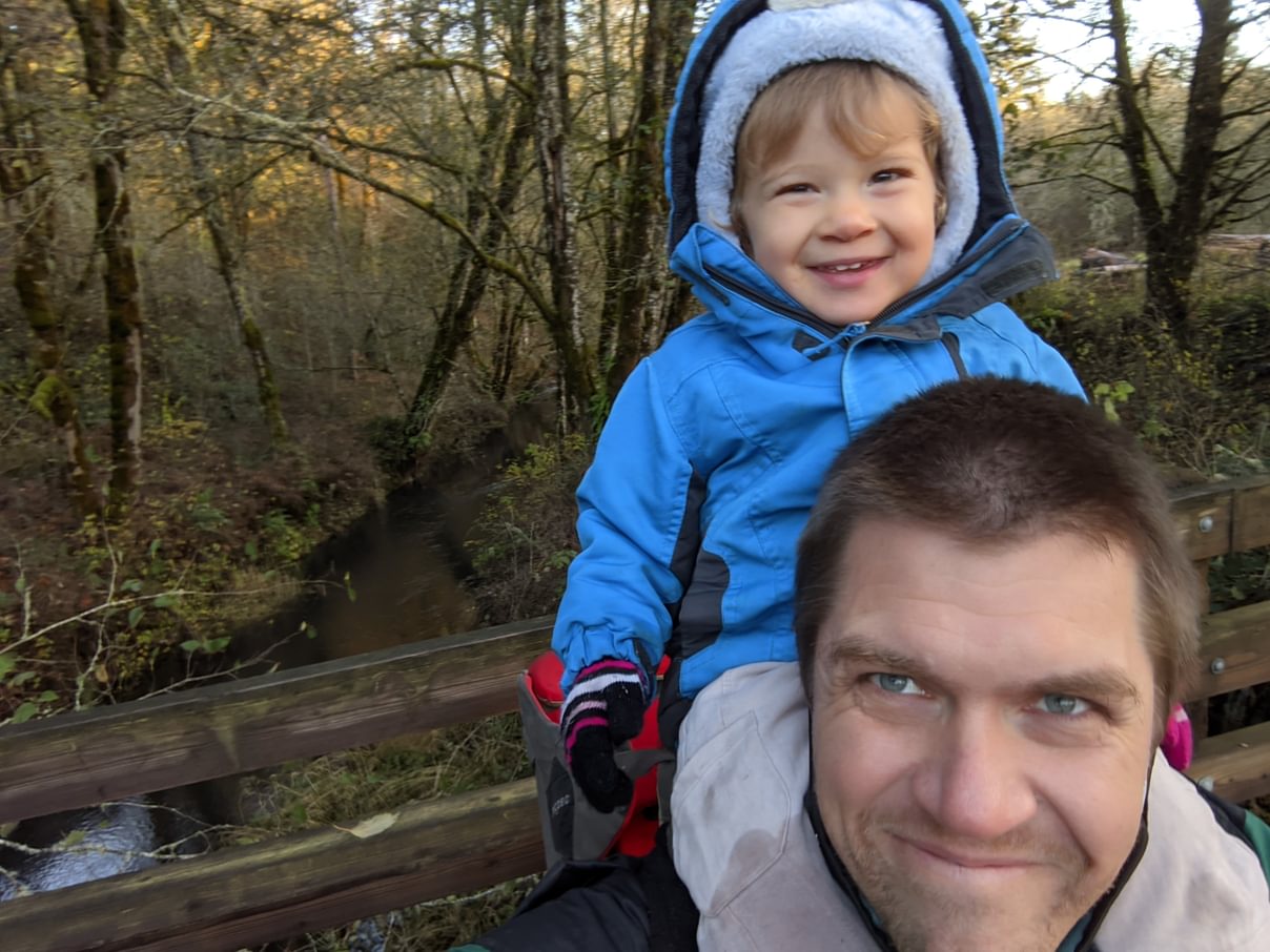
Bridges are frequent in this section, first over Beaver Creek and other small streams and then later the Nehalem River, and the crossings are always beautiful.
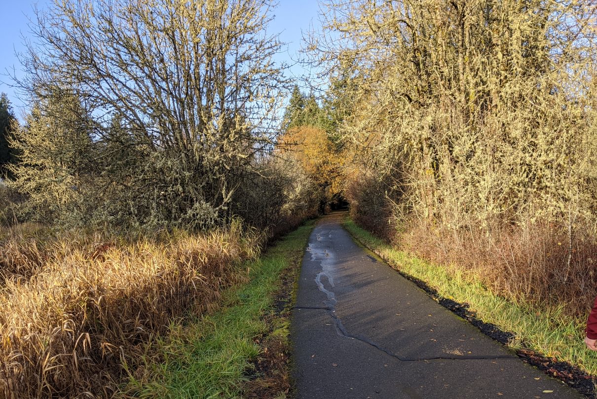
Not too far north of the Beaver Creek Trailhead, we emerged from the forest and began hiking through fields and thickets. This area isn’t quite as pretty or wildlife-friendly, and the miles began to add up.
Thankfully there was still the occasional stream crossing to add beauty and variety. Sophia started getting fussy and decided she was done with the pack, but there wasn’t enough time left to let her run around, so I had to carry her on the shoulders or in front.
By 4:30 we were losing daylight quickly, both due to the setting sun and rainclouds looming from the west. Unfortunately we still had over two miles to go. At this point the trail abuts the highway, not a pleasant experience. We picked up our pace.
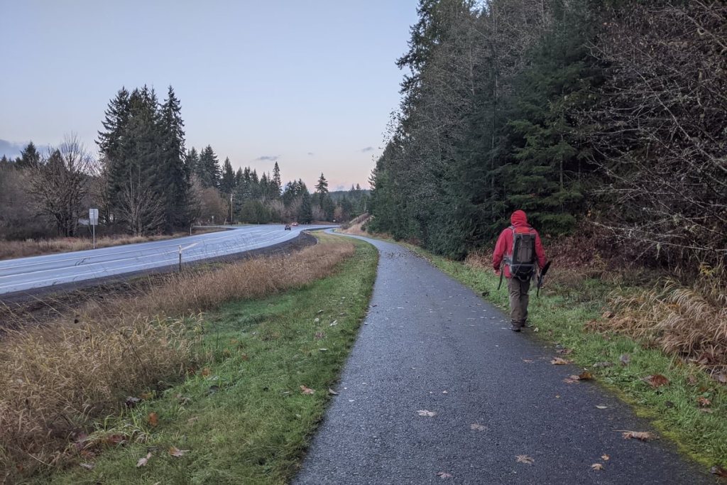
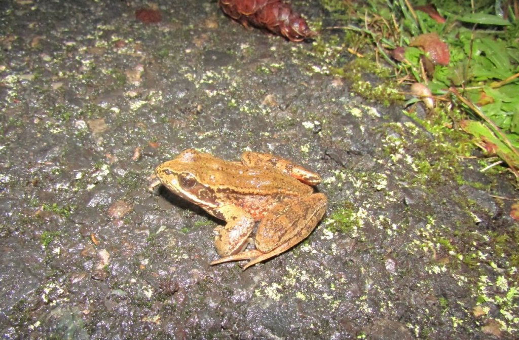
Clouds quickly rolled in, a drizzle was coming down, and we hiked in relative darkness. Matt surprised me when he suddenly stopped in his tracks – a red-legged frog was underfoot, taking advantage of the conditions to go on the move.
That last stretch was completed as quickly as we could manage. A few minutes before we reached Matt’s car, the floodgates opened and rain poured down. But we made it!
At 5:30pm, just under five hours and nine miles from when we had started, we dropped an exhausted baby into the carseat in Matt’s car. From there we had to return to Tophill Trailhead to drop me and Sophia off at our car, and then drive up Highway 47 and across Scappoose-Vernonia Highway in a storm. By 7pm everyone was back home safe and sound.
Next time I do Banks-Vernonia, I think we’re going to wait for a sunny day. 🙂
Banks-Vernonia State Trail at a glance
What: hiking
Where: Vernonia Trailhead (45.8558, -123.1920) is at Anderson Park in Vernonia. Turn south off Hwy 47 onto Jefferson Avenue in Vernonia and you’ll drive 0.5 miles straight into the park. You can also start at Vernonia Lake Park.
Beaver Creek Trailhead (45.8107, -123.2312) is off of Hwy 47 about 4.2 miles south of Vernonia or 10.3 miles north of Hwy 26.
Tophill Trailhead (45.7584, -123.2015) is off of Hwy 47 about 8.3 miles south of Vernonia just before the Tophill Trestle, or 6.2 miles north of Hwy 26.
Hiking: 4.3 miles from Vernonia Trailhead to Beaver Creek Trailhead and 4.4 miles from Beaver Creek Trailhead to Tophill Trailhead. Part of the 21-mile long Banks-Vernonia State Trail. More detailed hiking information can be found at Oregon Hikers.
Camping: L.L. Stub Stewart State Park is 2 miles south of Tophill Trailhead on the Banks-Vernonia Trail and offers 91 RV sites (13 horse sites), 12 walk-in tent sites, 15 cabins, and a hike-in camp.
Notable Wildlife: Barred Owl, Pileated Woodpecker, Pacificslope Flycatcher, kinglets, warblers
Property status: Oregon State Parks
Website: Oregon State Parks: Banks-Vernonia State Trail
Rails-to-Trails Conservancy
