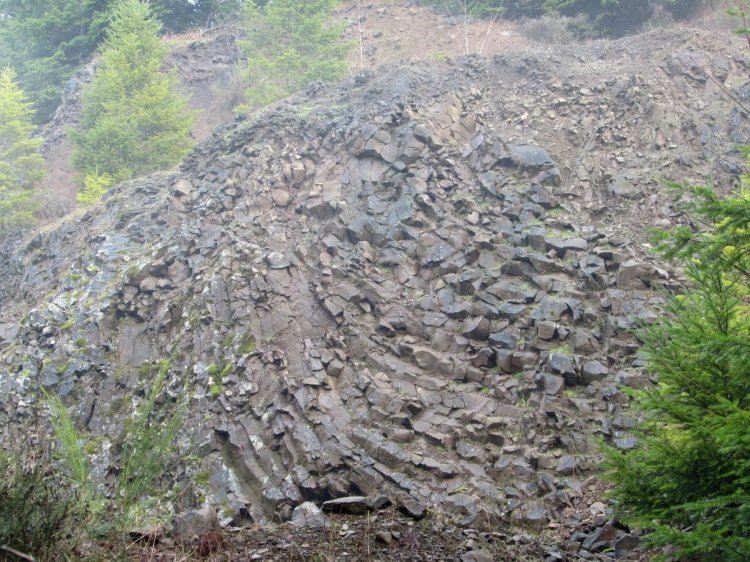
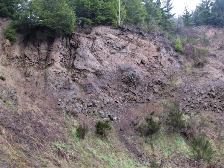
Layers of basalt from ancient lava flows helped form the hills of Columbia County. The basalt takes unique shape depending on how the lava cooled.
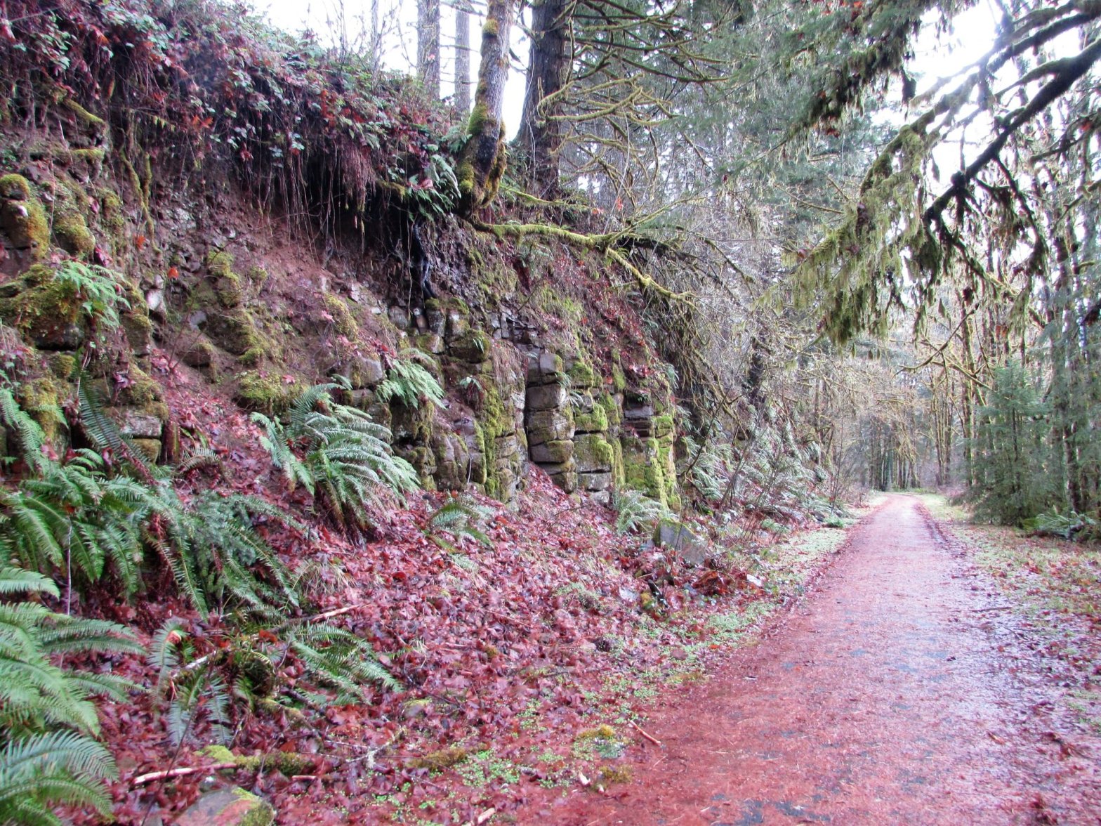
With the Crown Zellerbach Trail being an old logging road, there are a few areas where the road cuts through the adjoining hillsides and exposes the geological past. I (Matt) wanted to walk you through the cool features I enjoy in one such section, starting with the basalt rock cliff that overlooks Bonnie Falls.
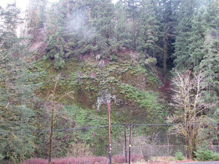
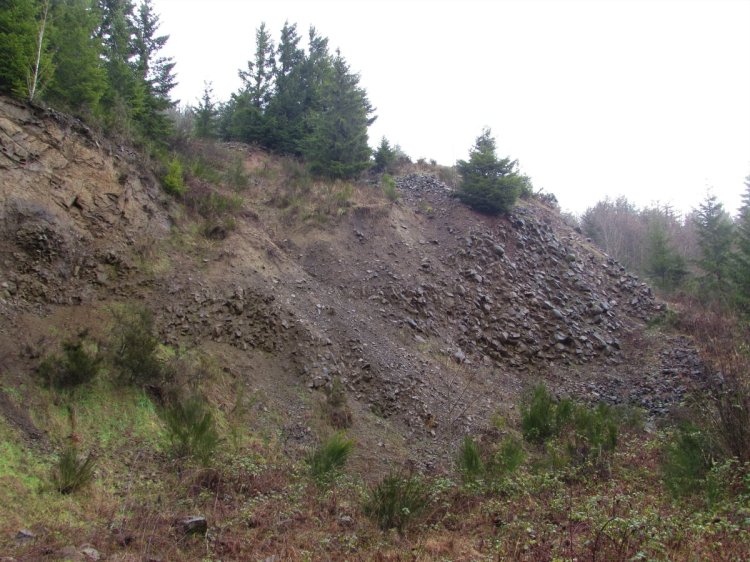
Rock cuts in these cliffs expose the volcanic history of the region.
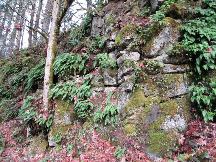
Here the rock next to the trail shows us what usually lies just beneath our feet.
An old quarry reveals many layers.
Tree roots slither their way amongst cracks formed by heating and cooling, over time breaking them down into smaller and smaller fragments.
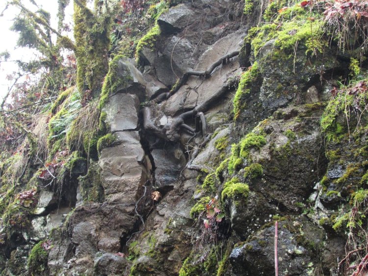
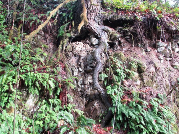
The cliffs are a great example of active erosion taking place. New life makes a home amongst the walls.
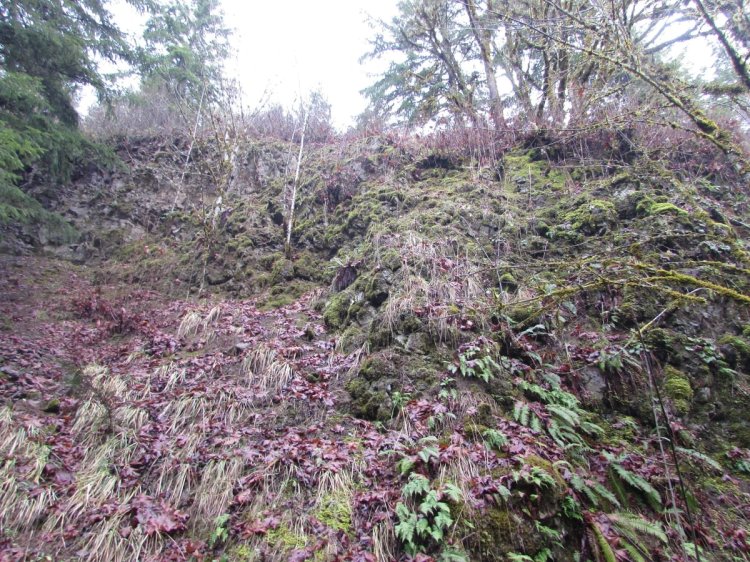
In such sections fallen rock is commonplace with both old and fresh rockfall at the base of the cliffs. These rocks are a great place to find woodland salamanders. 🙂
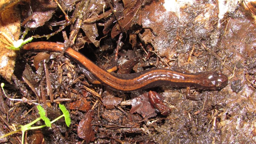
Western Red-backed Salamander 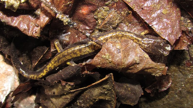
Dunn’s Salamander
You can find these geological features and more on the Crown Zellerbach Trail starting a little west of the Bonnie Falls Trailhead along to the Pisgah Trailhead.
Cool Geology Along the CZ Trail at a glance
Where: Pisgah Trailhead (45.7837, -122.9031) is on Scappoose-Vernonia Highway 1.7 miles west of Hwy 30, on the right just past Wikstrom Road.
Bonnie Falls Trailhead (45.8086, -122.9380) is 2.6 miles further down on Walker Road on the right, just before it intersects Scappoose-Vernonia Highway.
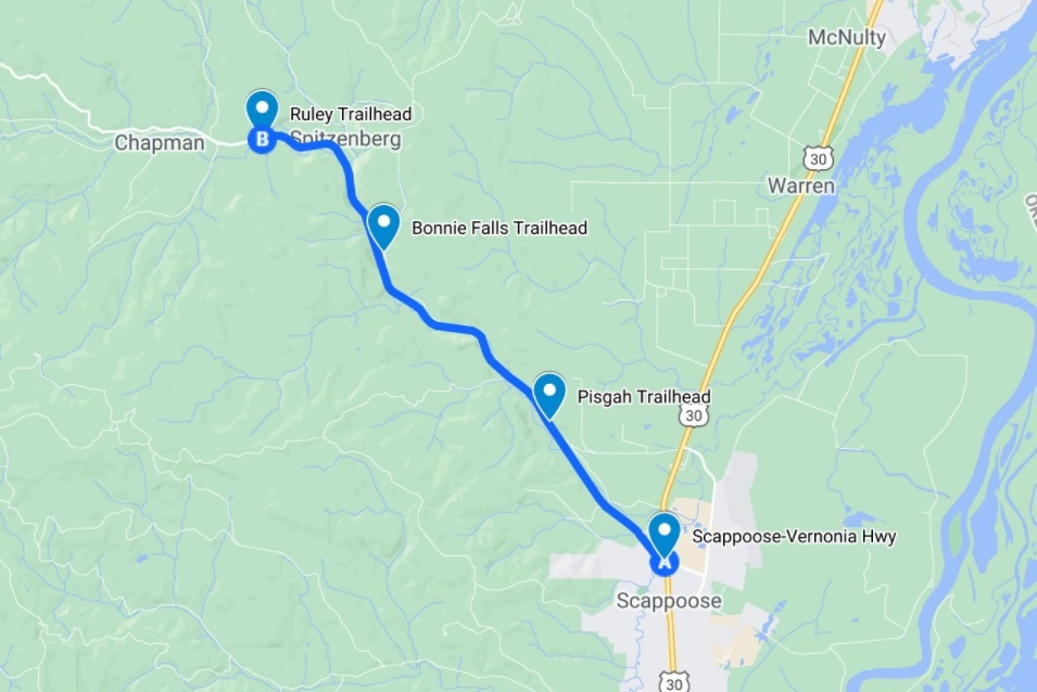
Hiking: 2.6 miles to get from Pisgah Trailhead to Bonnie Falls Trailhead.
Camping: none
Notable Wildlife: woodland salamanders
Property status: Columbia County Parks
Website: Crown Z Trail official site
Friends of CZ Linear Park Trail
