The Nehalem Divide stands west of Scappoose, separating streams that flow to the Columbia River from streams that flow to the Nehalem River. In 1920 a logging company tunneled its railroad straight through this barrier. This massive railway-and-logging operation pulled trees from Vernonia and across the Nehalem Valley out to the Columbia River, moving a million board-feet of timber a day. But unstable rock and constant collapses made the tunnel a liability, and by 1945 the rail line was abandoned.
Today the railroad’s only remnants are the flat bed it was built upon, pieces of trestle here and there…..and that extraordinary 1,712-foot tunnel.
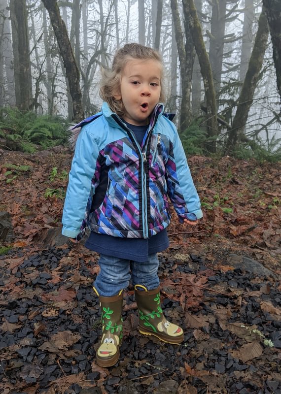
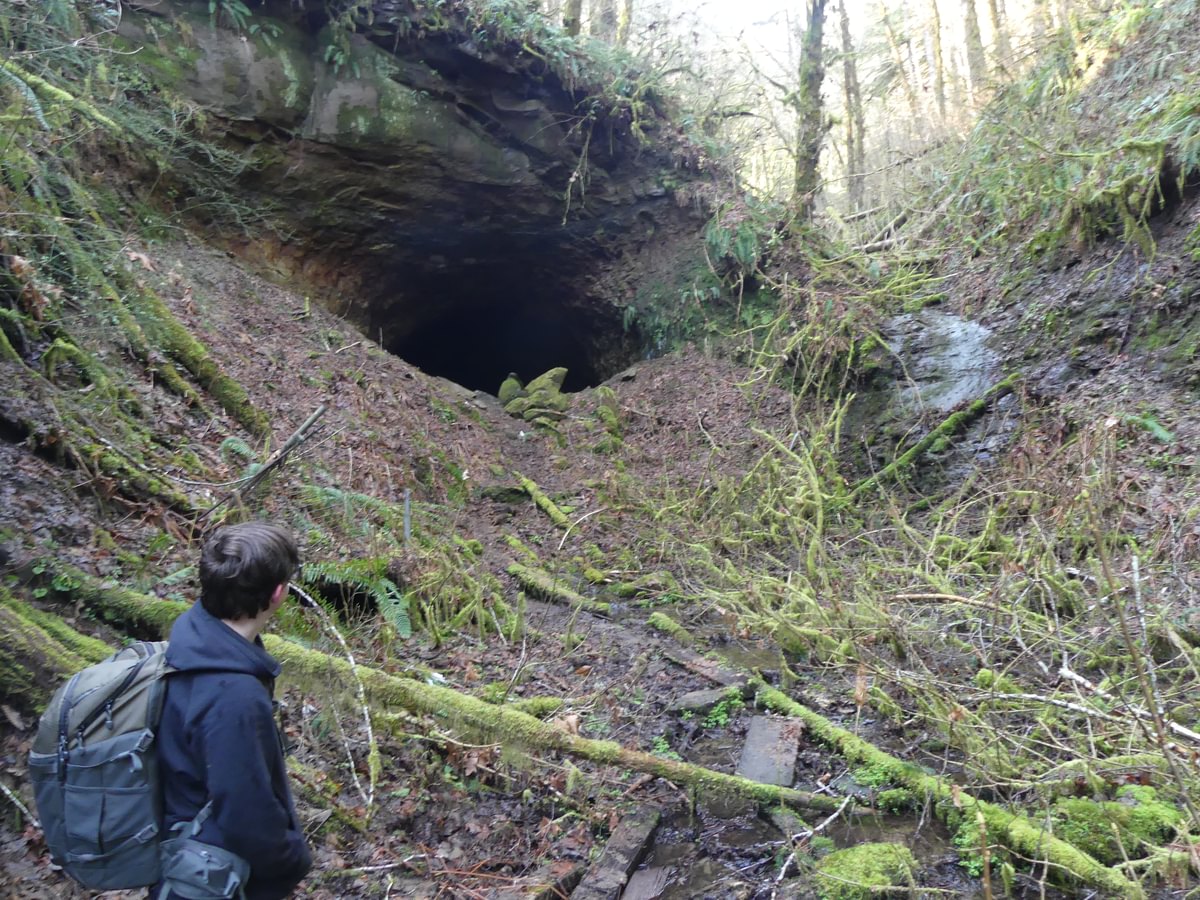
Matt, Sophie, and I went off to see the west entrance of this tunnel on a frosty December morning. The trek is short and simple, 3/4 of a mile west from the CZ Trail’s Nehalem Divide trailhead.
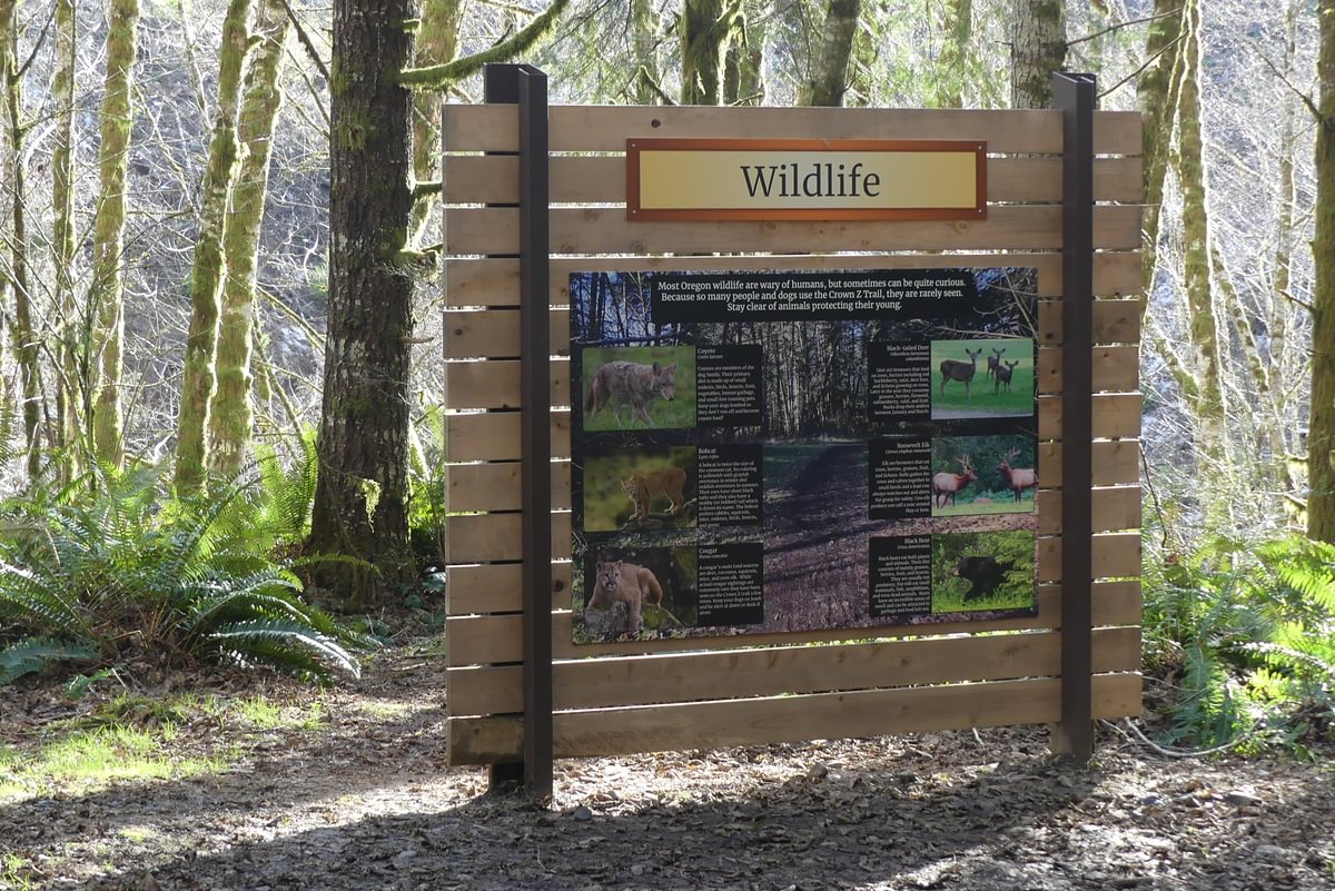
Once a local secret, the trail has become more obvious in recent years. It starts just left of the “Wildlife” sign and drops down the hill.
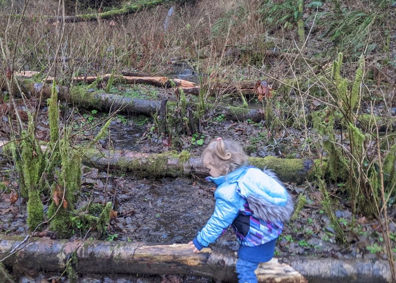
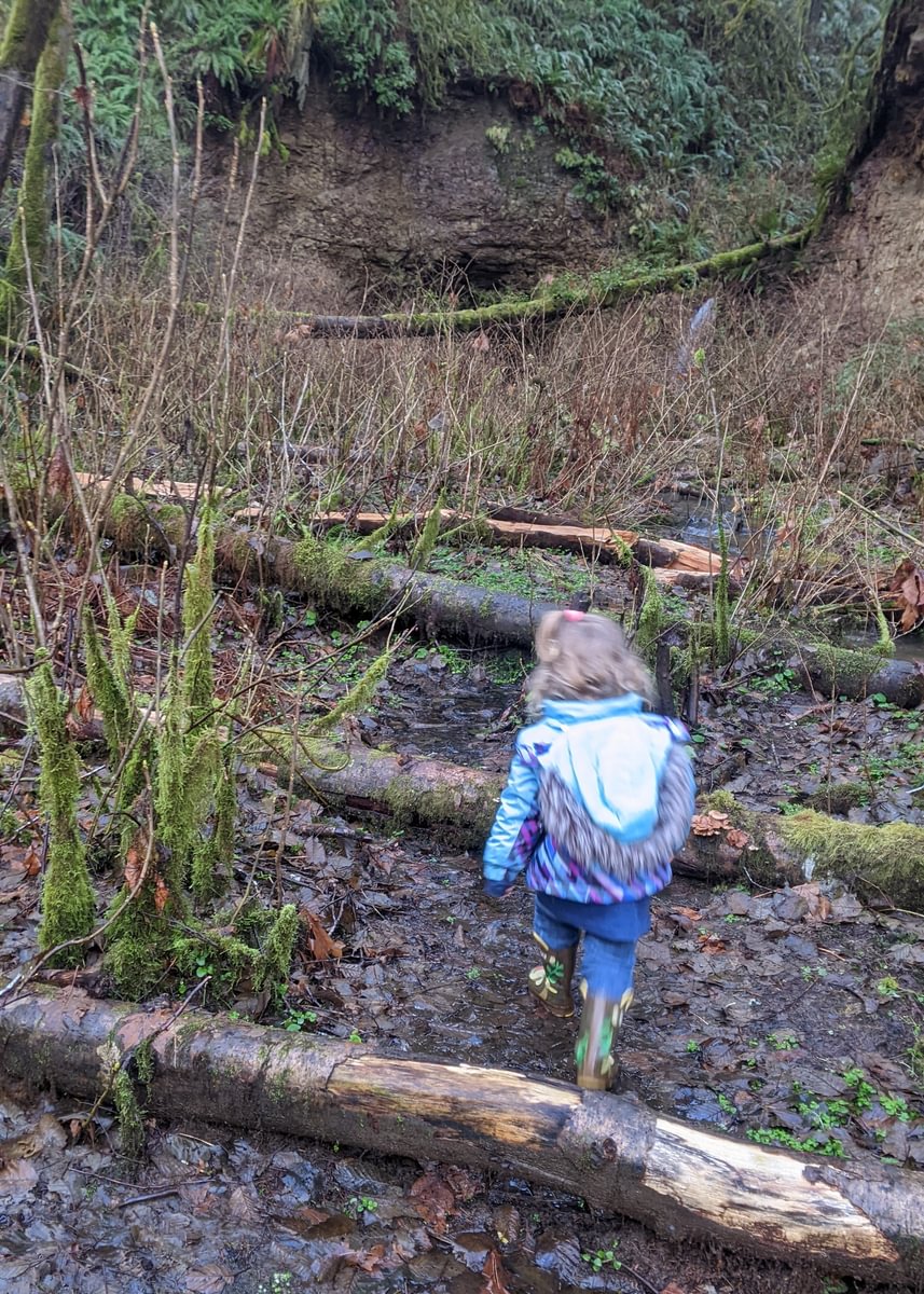
Don’t try this hike without footwear adequate for steep, slippery mud. With care and a tight hold on the little one we made it safely enough. The ancient railway bed that sits at the bottom of the ravine is a gorgeous wonderland.
I see the green and the stream and think “life!”. Sophia thinks “puddles!” She hurdled the logs and stomped through the flooded trail all the way down.
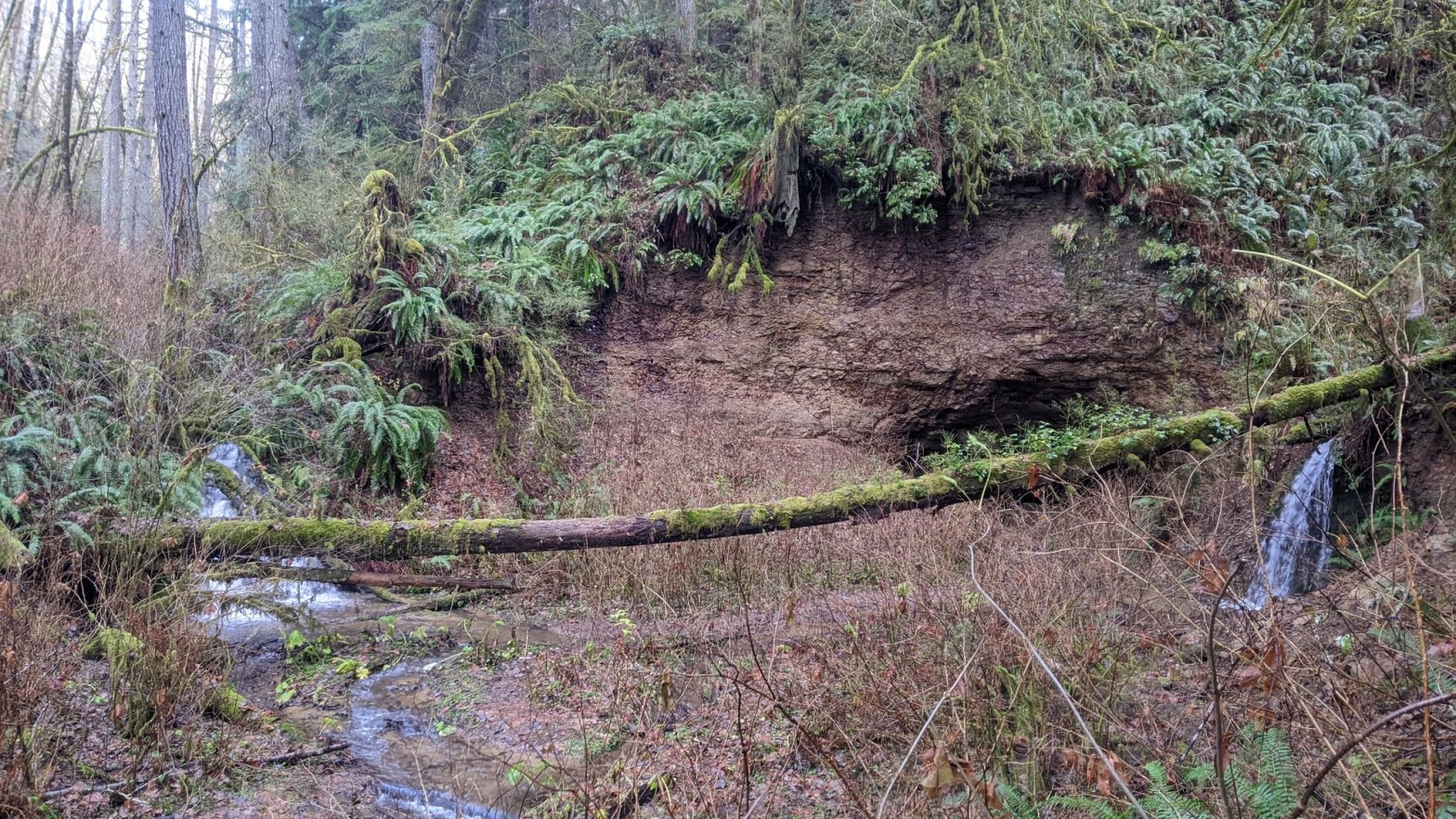
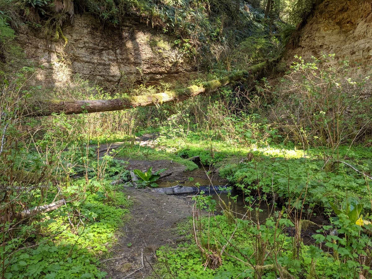
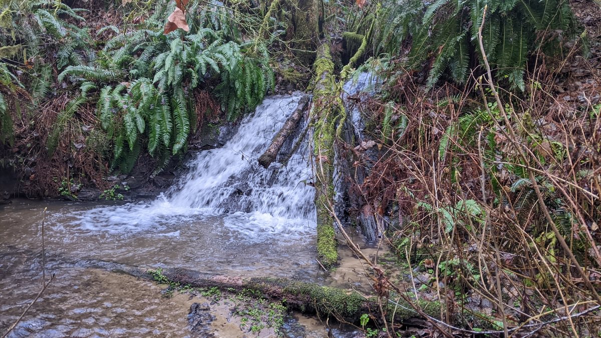
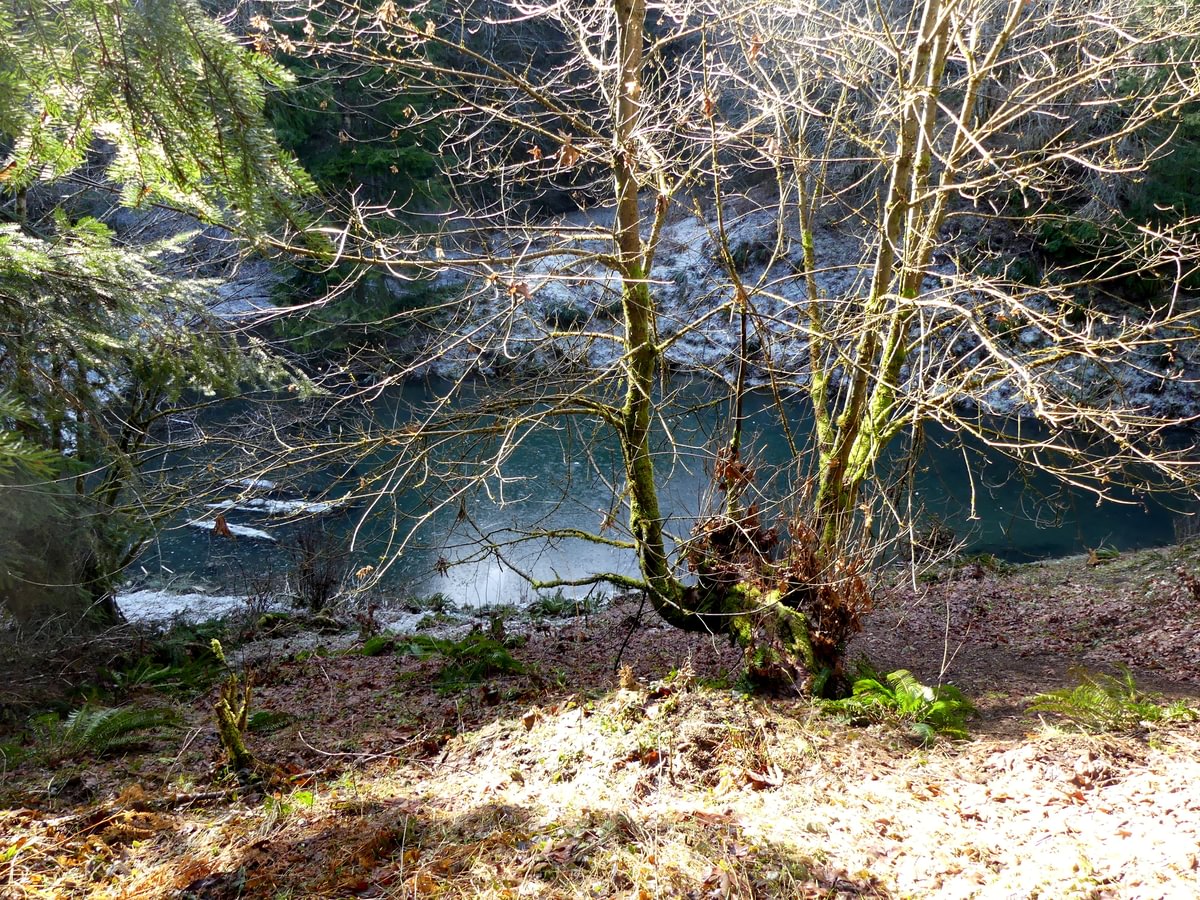
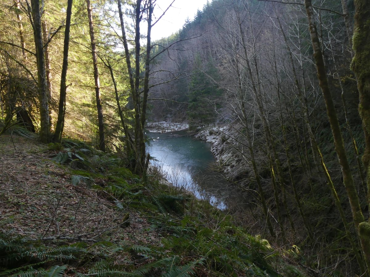
The ravine’s end is a beauty. A small stream comes down the cliff on your right, the East Fork Nehalem River comes down on your left, and the disintegrating tunnel gapes between them.

Who built this? The first transcontinental railroads employed teams of Chinese laborers among others, but by 1882 immigration from China had been banned by the Chinese Exclusion Act. Oregon railroad and logging projects instead recruited from European immigrants, Japanese immigrants, and Black Americans.
(Logger at St. Helens courtesy of Tai Fuwatake, Japanese American Museum of Oregon)
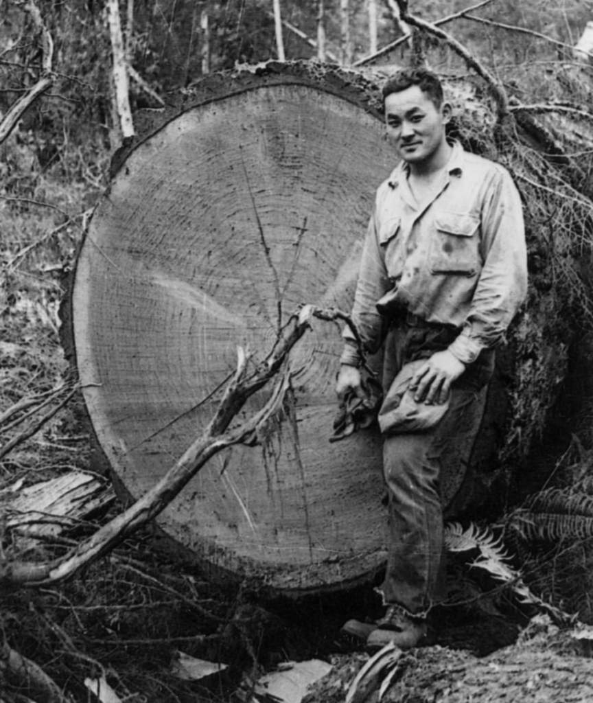
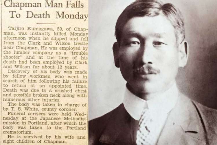
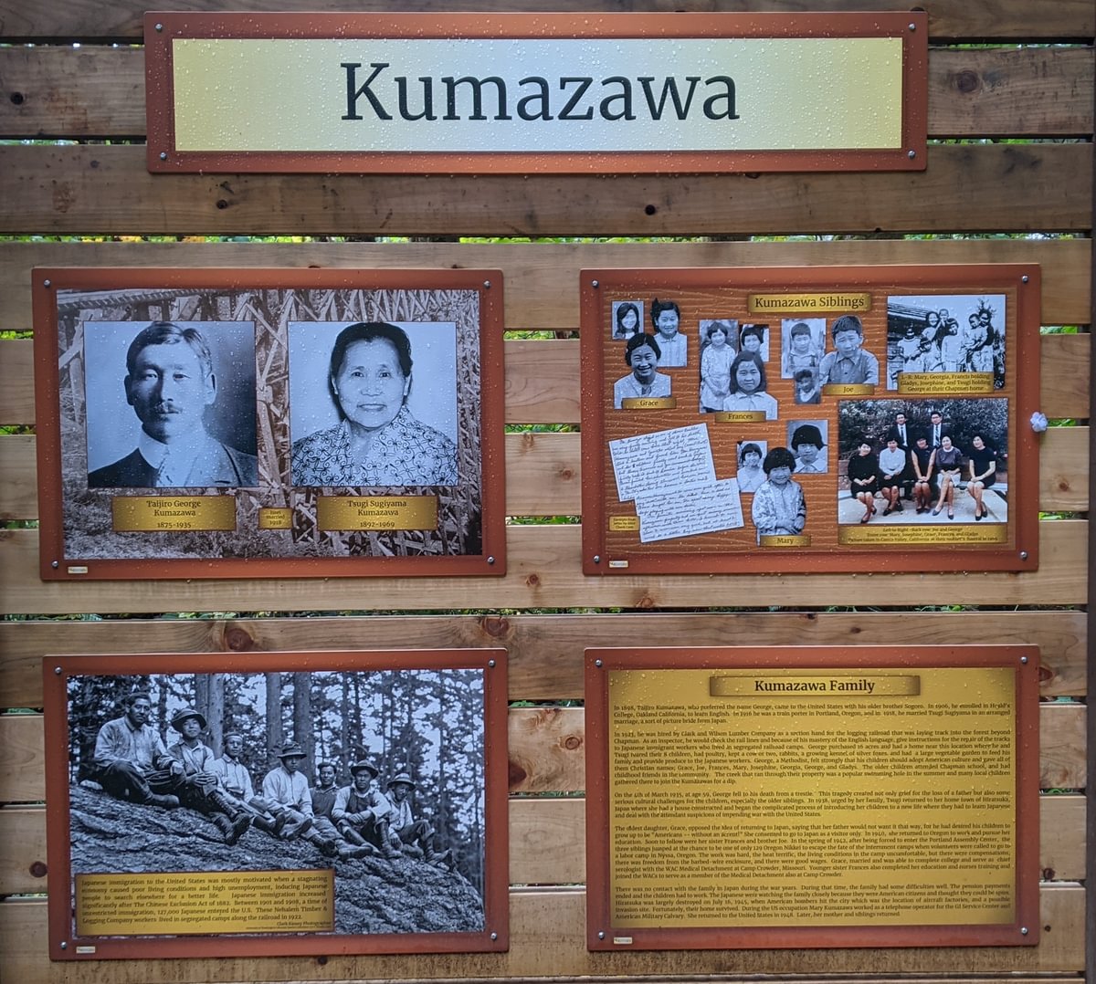
One such immigrant was Taijiro “George” Kumazawa, who came to America in 1898 and was working on Oregon trains at least as early as 1916. In 1920 he started a family on his farm in Chapman, the small community just downhill from Nehalem Divide. George would have passed through this tunnel regularly. Fluent in both English and Japanese, he often handled communication between the logging managers and the newer Japanese laborers. His 8 children were all born in Chapman and attended Chapman School.
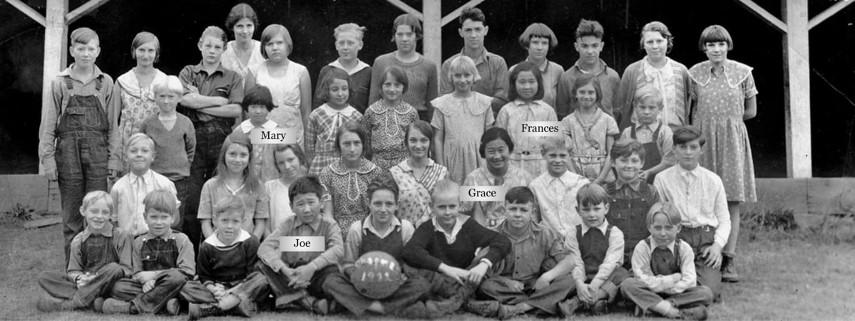
Tragically, George fell from a trestle on this line in 1935. Suspicions regarding the cause of his fall have lingered for decades. In 1942 George’s oldest children were taken captive by the U.S. government due to their Japanese ethnicity (despite being US citizens born right here in Chapman) and given a choice between labor camp or internment camp. They worked in the labor camp for a time and then left to the Midwest to dodge internment.
George’s was not the only local railway death. In 1908, when the train line ended halfway up the divide, six immigrants were killed in Chapman after the train’s brakes failed as it came down the hill. It is likely there were other deaths that haven’t been as carefully documented. I look at the tunnel, 1,712 feet of loose sandstone dug out entirely by hand, and wonder if men lost their lives in its very construction.
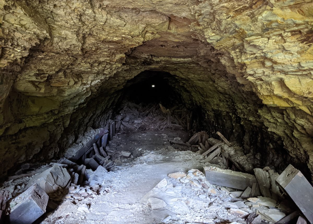
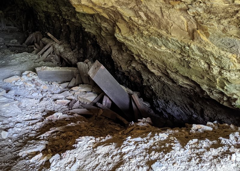
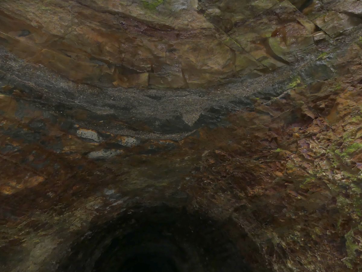
Cave-ins were common even when the tunnel was in use. The wooden supports weren’t sufficient – sandstone and clay doesn’t hold up without concrete reinforcements. In 1943 the Clark & Wilson Lumber Company tired of the collapses and gave up on the line, selling the land to Crown Zellerbach Company. In 1945 Crown Zellerbach shifted to a truck route, following the stripped-out rail bed in most places but avoiding the tunnel to instead route the logging road over the divide and along the same path the CZ Trail follows today.
As late as 1982 a historic survey showed that some of the tunnel’s structure was intact (though a cave-in can be seen further down). Considering the current decrepit state of those same wooden supports, the deterioration of the tunnel must be accelerating.
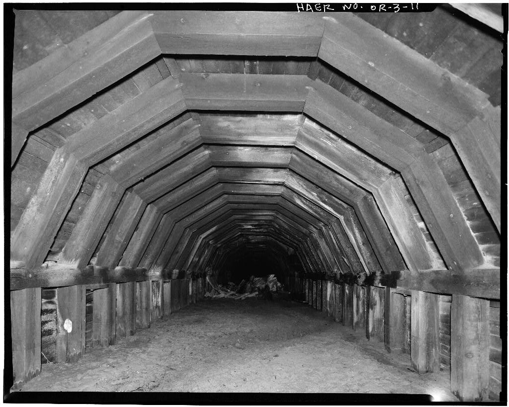
Going inside is dumb and dangerous. Stand at the entrance when the ground is wet, and soon you’ll hear the crunching sounds of pieces of roof falling. Some larger than others.
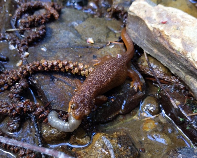
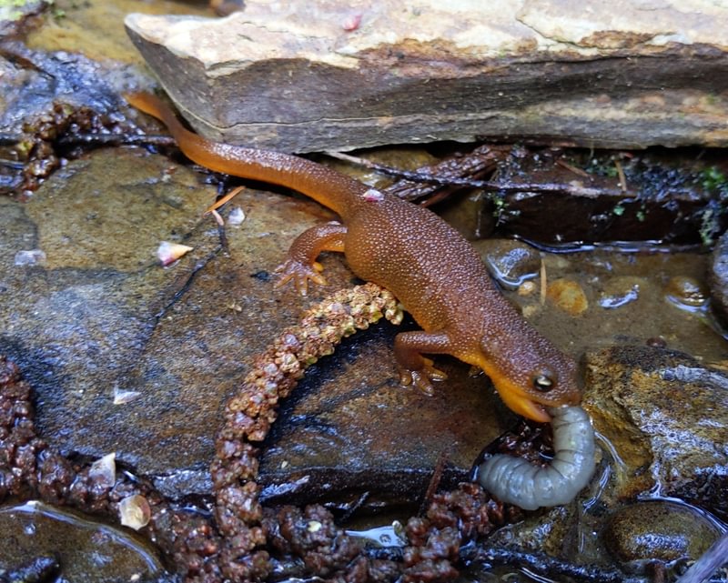
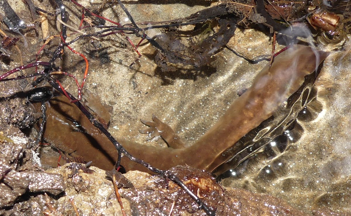
Turning our backs on the tunnel we enjoyed the rest of the canyon. The waterfalls are small but beautiful and full of life. Matt found a juvenile Western Red-backed Salamander in the rubble, and I’ve seen Dunn’s Salamanders in the waterfall and a Rough-skinned Newt eating a grub.
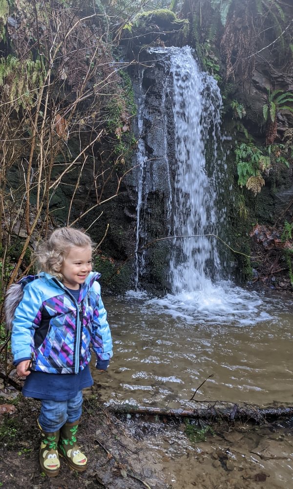
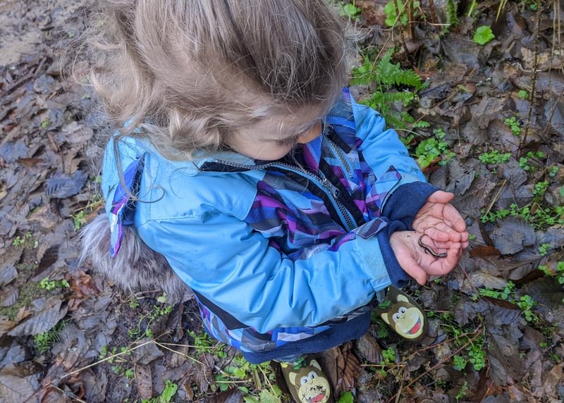
Having explored as much as we could, we headed back up the mud-slicked trail. Sophie made it without a slip, fully secured by her papa’s hands. It was a good day.
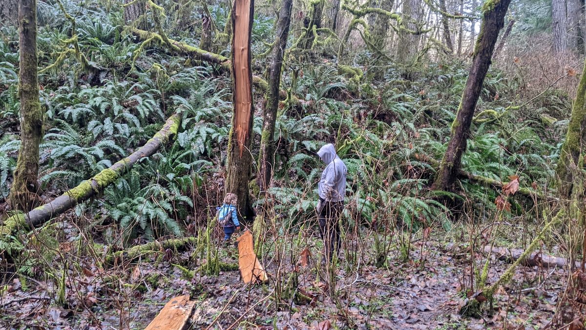
A month later, Lucas and I went to explore the east entrance. This end is a bit harder to find. Proceed east on the Crown Z Trail about 3/4 of a mile and then take a light use trail going west. I’ve tried a couple, with one obvious but steep at 45.8330, -123.0396 and another less steep at 45.8322, -123.0383. Either way, turn right when the slope flattens a little onto the ancient rail bed and head gently northeast from there. You’ll end up looking down on a large beaver pond. Don’t go down!
Keeping the beaver ponds to your left, just follow the light trails along the relatively flat pathway and within 250 yards you’ll reach the tunnel.
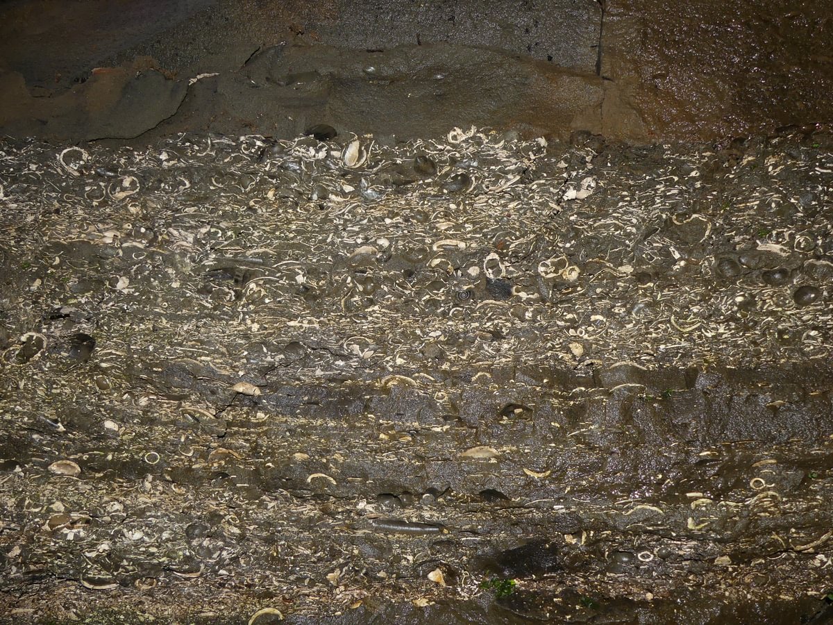
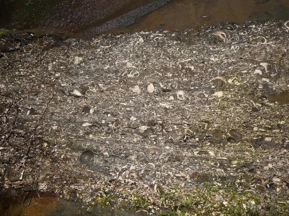
As with the west side, the tunnel is too degraded to enter. But just outside of the entrance a vein of dense fossils is visible above your head, a relic of the ancient seafloor that once covered this area before tectonic activity uplifted the divide.
Lucas and I poked around the outer stream for salamanders, but the winter temperatures were still too cold. A month later, though, I turned up several larval Coastal Giant Salamanders right here. Please don’t step on the boards/rocks in the stream as you could easily end up crushing one of them.
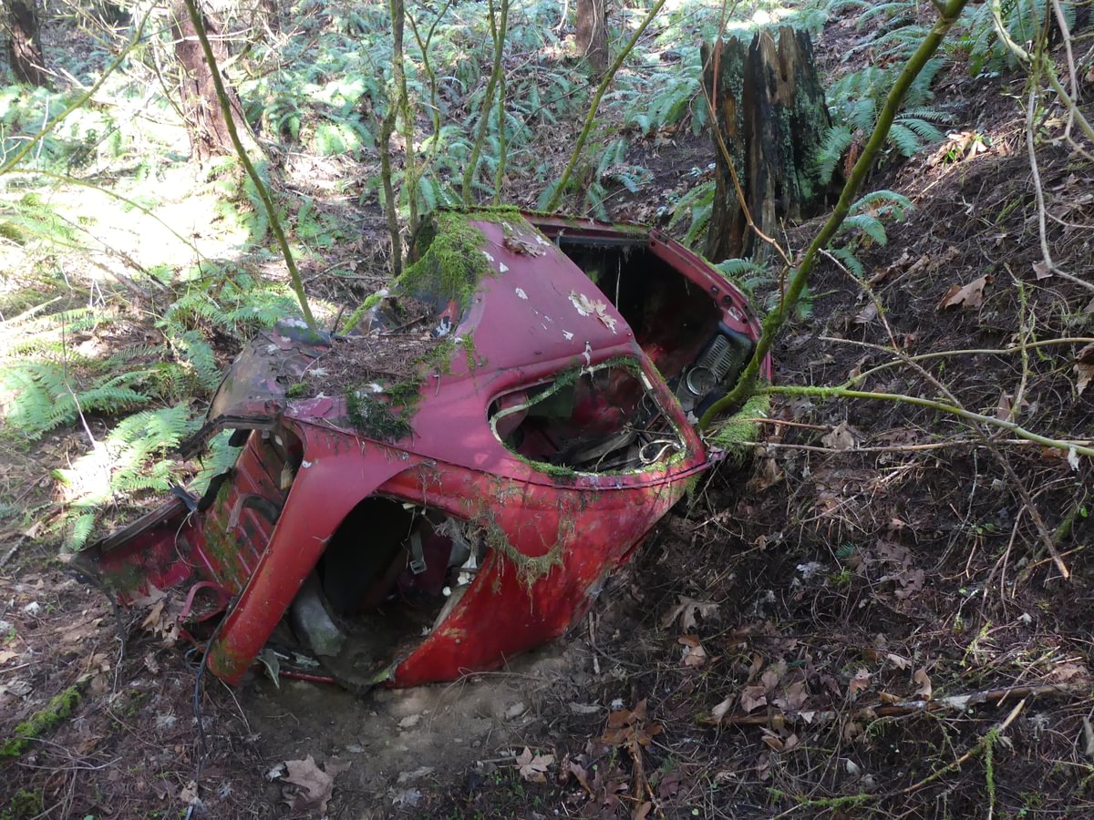
On the way out we found this long-abandoned vehicle carcass. Anyone wanna guess when and how this poor guy ended up down here?
A few minutes later and we were back on top. We hiked down the trail, paralleling the line where so many men and women worked themselves to exhaustion and sometimes worse a century before.
Well, every Monday morning
When the bluebirds begin to sing
You can hear John Henry a mile or more
You can hear John Henry’s hammer ring
Lord, Lord
You can hear John Henry’s hammer ring
Pictures and information on Taijiro Kumazawa and his family comes from the Columbia County Historical Society and the gracious assistance of Les Watters. Picture of Japanese logger comes via Kiyo Endecott, Lucy Capehart, and the Japanese American Museum of Oregon. You can read much more about the Kumazawa family on the official Crown Z Trail website, and there is a historical sign with their story and updated pictures on the Crown Z trail itself.

Good read and enjoy history. Ty for posting this.
LikeLiked by 1 person
Thanks Mark!
LikeLike
As a little guy back in the 70’s, we used to go exploring on that old railroad line (we lived close by). Several of the trestles where still standing (barely) and that east entrance was still fairly intact. We would throw rocks into the tunnel and bats would come out. It was too scary for us to ever go in! It could be a “hot” summer day but there was always a cool damp breeze flowing out of the tunnel. Our imaginations soared with wonder about what it must have been like when the logging railroad was operating.
Such a great article, thank you!
LikeLiked by 1 person
me and a couple of friends went through it and it was pretty cool however there was some areas we had to make a bridge to get across the water unfortunately i fell in once and got soaked but i didnt complain it was a fun experience including that we went in the middle of the night but it was overgrown and was hard to get to not to mention getting back to out vehicle was very difficult because the other side was very overgrown and we had to climb the hill back to the trail to get to our vehicle and when i say climb i mean we literally climbed the hill like a tree we didnt have any fear going into it but i dont think ill do it again since i got soaked and it smelled rancid to the point i almost threw up but otherwise it was fun if i did go back in there i wouldnt be worried about it collapsing unless u go in there and make alot of noice otherwise its fine as long as u dont mess with the walls or make any loud sounds me and my friends were perfectly fine coming out of there
LikeLike
The Tunnel has collapsed for good. Couldn’t see any light coming through on my last trip there 9/7
LikeLike
That’s fascinating. Emphasizes how real the danger was (and still is).
LikeLike