
As the crow flies we were half-a-mile southwest of Keasey Road when we discovered the relics of a forgotten dam in Rock Creek.
Too bad we can’t fly like crows. It took a LOT more work to get there, especially since we didn’t know there was a “there” to find. So here’s how we found Keasey Dam and what we saw along the way.
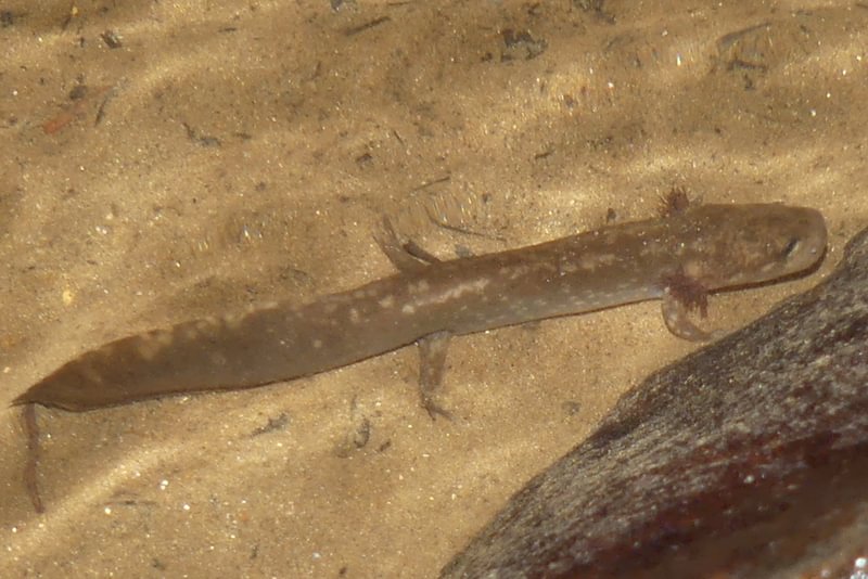
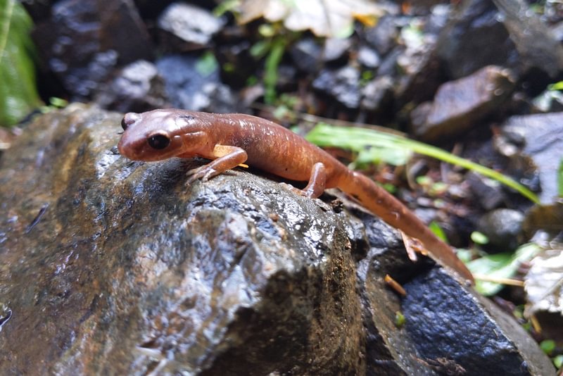
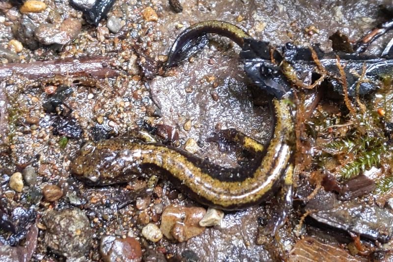
Rock Creek is one of the wildest remaining waterways in Columbia County. Matt and I prefer to reach it by parking at the remote end of Keasey Road (you need a Weyerhaeuser Pass to hike here) and then hiking southwest along the dead hiking road that ends up paralleling the creek. Salamanders of various types appear along the way.


Take a good map and be careful because the creek is over 100 yards from the dead road and you have to drop about 100 feet in elevation to reach it. Winter or summer, Rock Creek is beautiful.

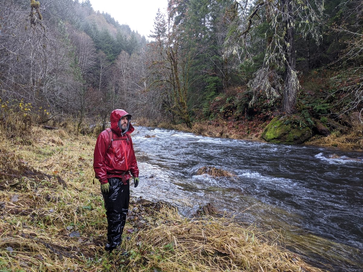

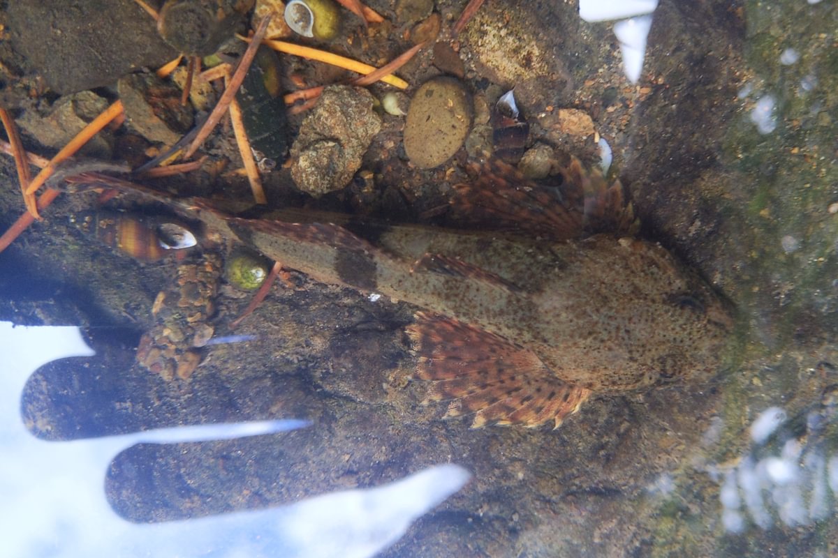
Once safely down the slope we head upstream along the winding creek. Late in summer you can make your way by wading when necessary, but in winter/spring when the flow is higher you have to climb up in spots to avoid being cliffed out. The preservation of the natural habitat of this creek has allowed it to be a top-3 spot in the county for finding the relatively rare Columbia Torrent Salamander, along with several other stream denizens.


The third time we followed the creek we pushed further than before and an old bridge appeared before us. And behind the bridge….what is that there?


Why is there a huge concrete structure so far up the creek? We had to take a closer look.
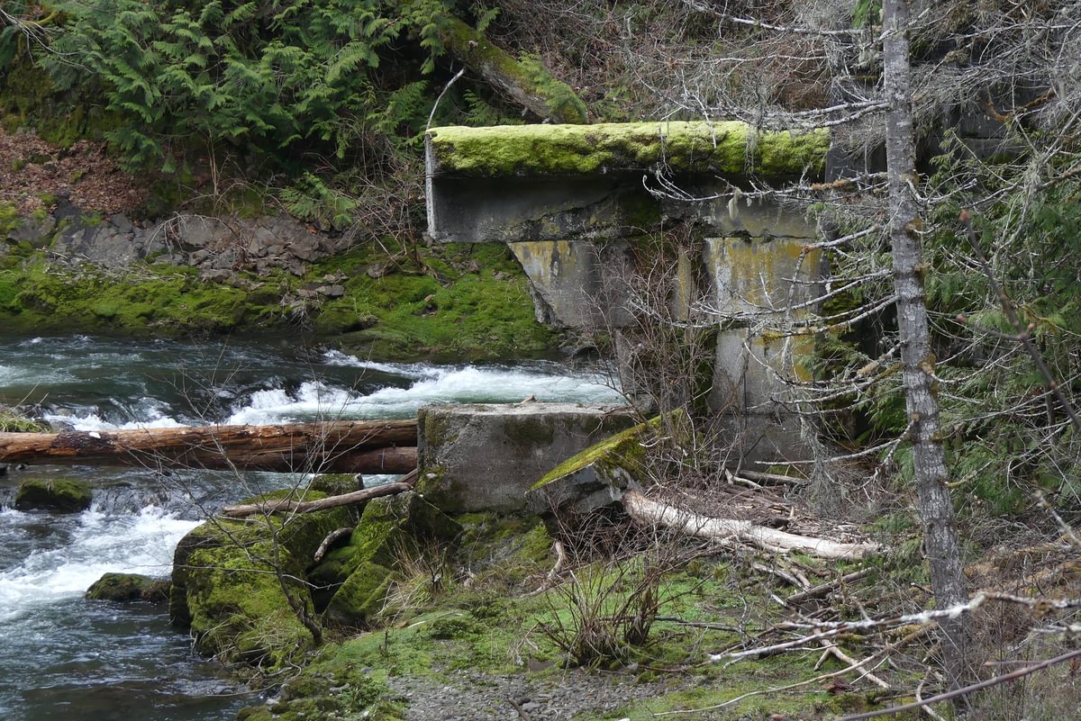


We knew nothing of the history of what we were looking at. Answers came in the book “Vernonia“, by the Vernonia Pioneer Museum Association. It turns out that this dam was built by the Vernonia Power and Light Company in 1922 and was the original source of electricity for the town of Vernonia. In the book they have old pictures of the dam in its glory days. It is by far the oldest fish ladder in Columbia County, though the ladder was so steep that we wonder whether the fish runs may have struggled to get up it.
In the 1940s Vernonia got hooked to Portland’s power grid and the Keasey Dam became obsolete. It was blown up in 1947 in order to allow the salmon and steelhead runs to gain easier passage up the creek. Taking down dams to help fish populations 75 years ago, who knew?
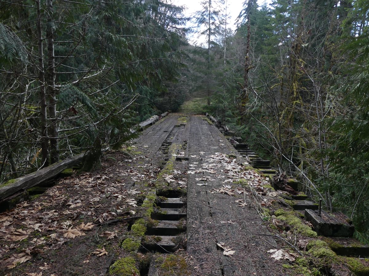
The bridge itself was also old and quite interesting:
If you wanted to make it here on logging roads without following the creek, you could hike in 4-5 miles by parking at the gate at Selder Creek Road off of Boeck and coming in from the north, or in 3-5 miles (depending on which cutoff paths you take advantage of) by parking at the end of Keasey Road and coming along the Eastside Grade from the east instead. Both routes require a Weyerhaeuser pass.
On this day we chose to continue on the road west and visit Ginger Creek, which was beautiful but not particularly abundant in aquatic life due to its position between two clearcuts.


We then doubled back to the bridge and took a zigzagging roundabout route on logging roads and cutoff trails east and north to get back to the car. Along the way we saw more wildlife including a lot of elk.


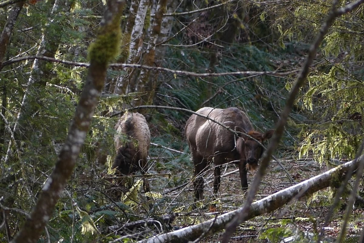

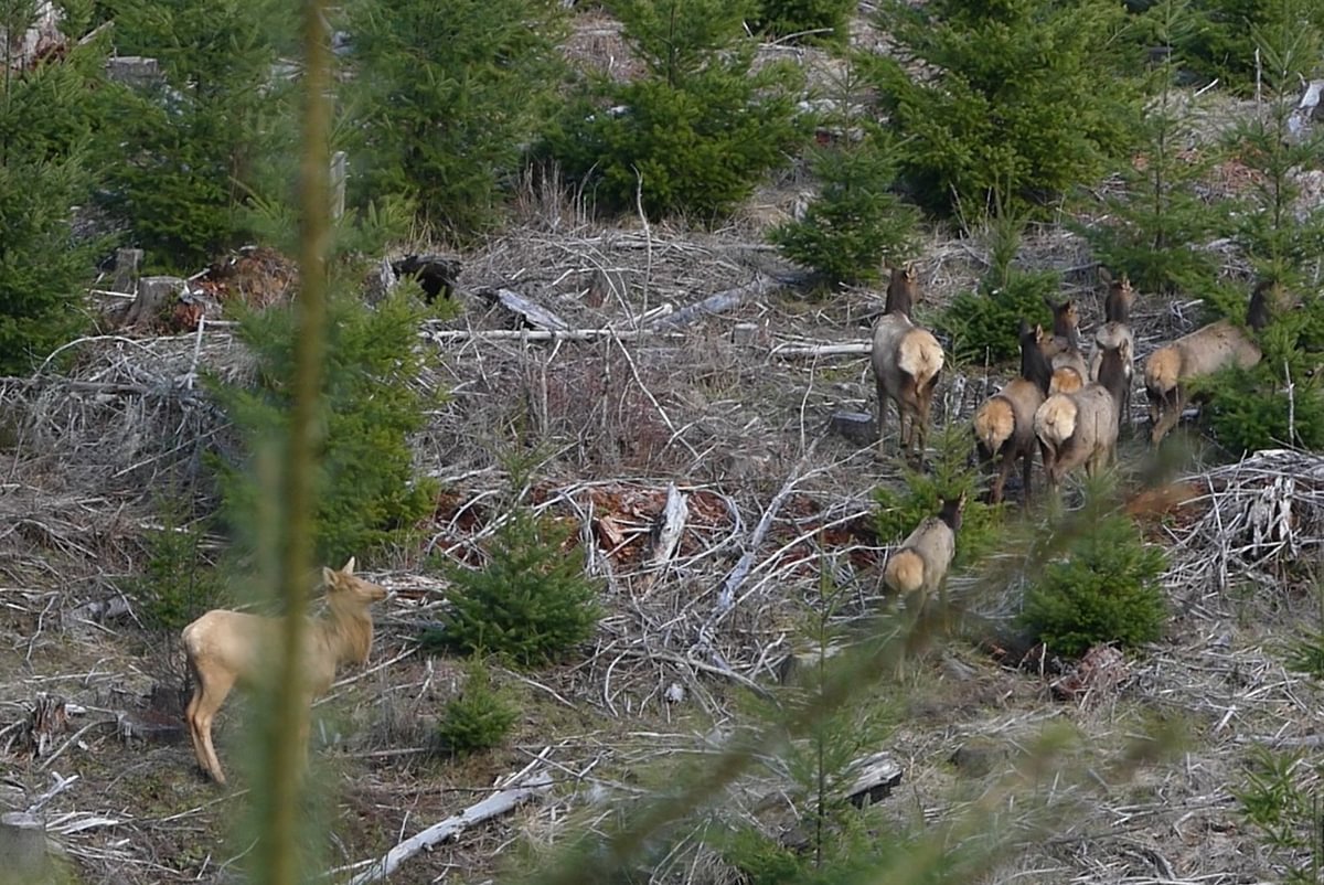
Wait, did you see that blond beast there?

We don’t know much about these blond elk other than that it’s some sort of color phase variation, appearing like the lack of any black pigmentation. This is the best example I’ve seen of one in real life.
We finished the hike off without incident, very happy with the discovery of the dam, the elk, and the great herpetological diversity. Matt has created a video of our adventure, with more focus on Rock Creek and the elk herds:
Like he said, it was a good day.

Thank you for sharing!
LikeLiked by 1 person
Awesome salamanders and cool detective work. That’s certainly interesting about breaching the dam after it had served its purpose. Thanks for posting the video — it does look like a steep, fun hike!
LikeLiked by 1 person
super cool hike, in my neck of the woods1
LikeLiked by 1 person
It’s illegal to fish that high on the creek signs are posted as you are driving up.
LikeLike
Nice article and video! There is a bridge just like that one (but still in good shape as it is still used) on Flack rd off of Keasey on the left.
LikeLike
That was a great article. I have been to that damn hundreds of time. My family built alot of those logging roads and rocked them over the years. We have keys to all the Gates…Spents lots of time up there. We use to throw keggers at that damn in high school. Our Senior Kegger was there. Thank you so much for this article.
LikeLike
I am from vernonia and i was wondering hoe I find that creek with the waterfalls ? That looks beautiful. I know how to get to the damn so I can hopefully make it from there?
LikeLike
If you cross the bridge going west from the dam and then follow the main logging road south about 1.5 miles, you’ll reach a clearcut with a ravine in it. The stream is in that ravine. You’ll have to cross a few hundred feet of clearcut somewhat steep downhill to get to it. Be careful around the stream, parts of the bank dropping down are extremely steep and have very little in terms of stable handholds. Take your time and choose a safe place to drop down, a few areas are really sketchy.
Another way to reach would be to just follow Rock Creek upriver until you got to the mouth of the stream. But that would be a lot slower.
Warning – in late summer the flow in that little creek is quite low and it doesn’t look as nice. Much prettier in winter/spring. But you’ll have to be that much more careful when visiting in higher flow.
LikeLike
Any way you’d be willing to share a few GPS points to help a fellow explorer out? We know the area fairly well but need some markers just to help us as guiding points on where to go. Even just the GPS coordinates to the Dam would be so very helpful and appreciated. We can always find our way there as long as we know where to look!
LikeLike
EL – you responded to a response so I can’t reply directly, so I hope you see this. Send me a message through the contact form and I’ll response privately.
LikeLike