“I [s]lept but verry little last night for the noise Kept [up] dureing the whole of the night by the Swans, Geese, white and & Grey Brant Ducks &c. on a Small Sand Island … they were emensely noumerous, and their noise horid.”
Diary entry of William Clark, 5 November 1805
Sauvie Island has long been renowned for its abundant life. Well before Lewis and Clark were annoyed by the birds, the Multnomah tribes of the Chinook people used the island as a gathering spot. They were blessed by multitudes of ducks and geese, sturgeon and salmon. Perhaps most important was the wapato, an aquatic potato-like root cultivated in the fertile wetlands as a dietary staple.
Today the island continues to bless. The Multnomah County half showcases berry, fruit, and vegetable farms, while the Columbia County side is occupied by the 11,643 acre Sauvie Island Wildlife Area, a waterfowl preserve that comprises the bulk of Columbia County’s public lands.
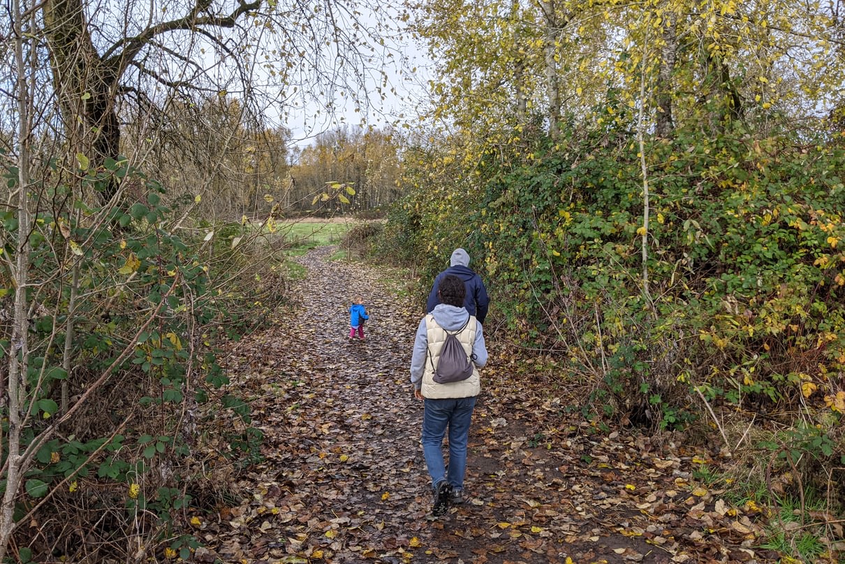
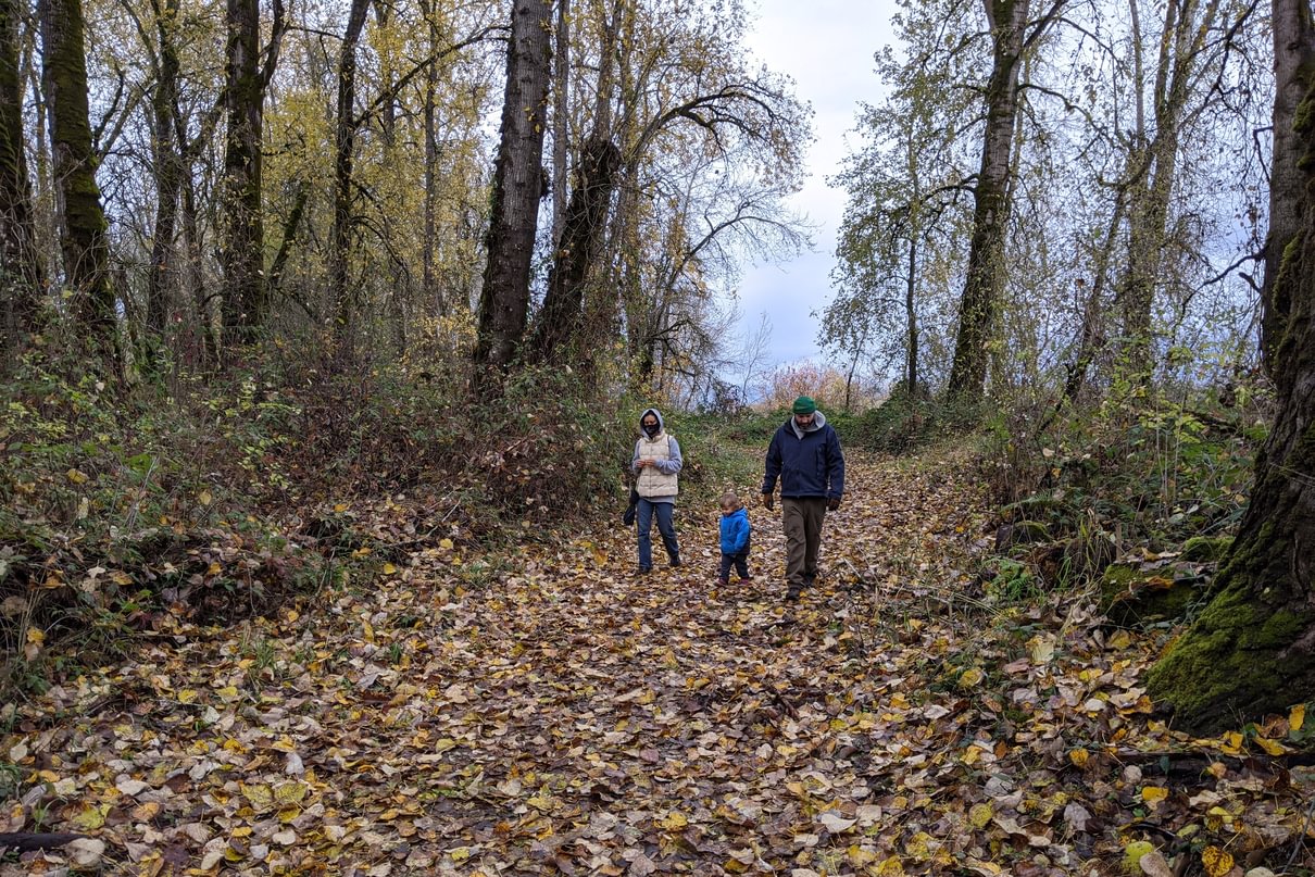
Winter is the best time to view the waterfowl. Unfortunately winter is duck hunting season and thus much of the area is closed to hikers. (Don’t hate, hunters were the ones with the foresight to set aside a preserve in the first place!) One cold November morning, Rosey, Sophia, Matt and I set out to see what we could discover in the spots still open in winter.
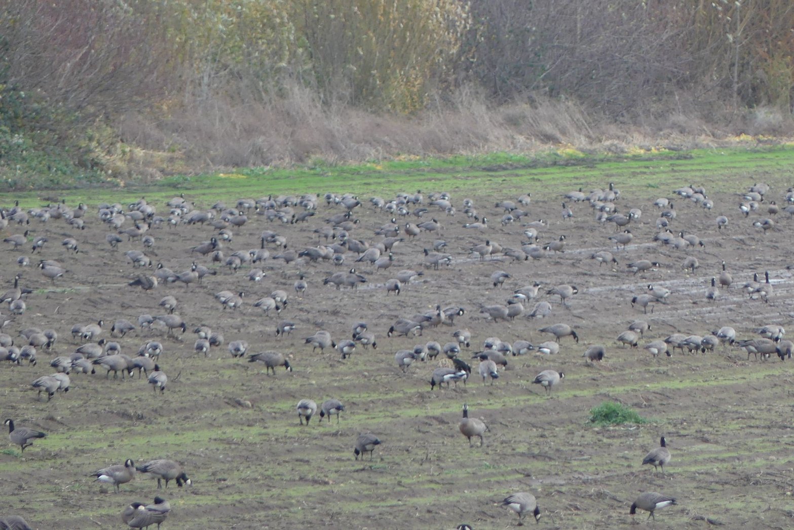
We started by buying day-use permits at the Cracker Barrel Grocery just past the bridge (required for anyone visiting the reserve). Across from the grocery, geese foraged in huge numbers alongside a smattering of gulls and cranes. These are Small Cackling Geese, a smaller, blunt-nosed cousin of the Canadian Goose. This subspecies spends its winters almost exclusively within the Willamette Valley and Sauvie Island.

Small Cackling Geese 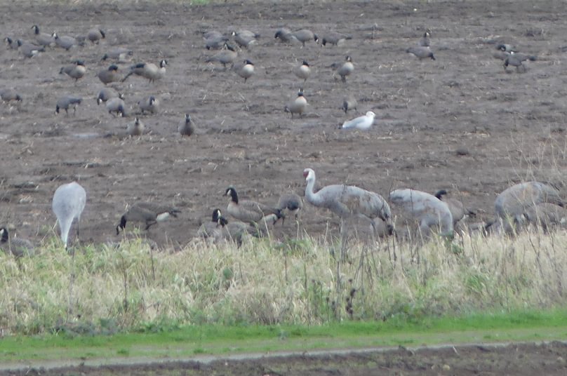
Greater Sandhill Cranes
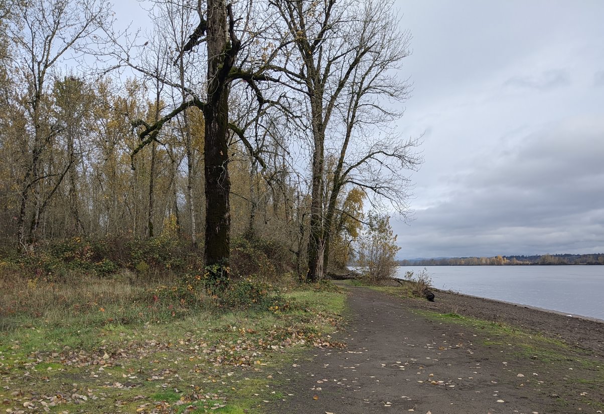
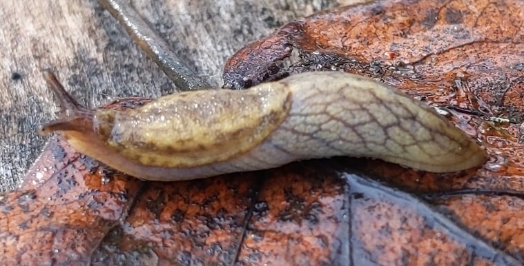
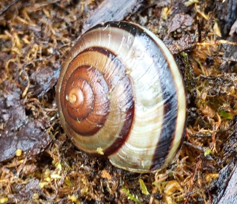
Our first destination was Willow Bar Islands trail, a 3-mile out-and-back alongside the Columbia River on the eastern edge of the island. Far from the duck hunters, it proved to be a quiet, pleasant trail, easy to walk and relaxing to spend time on. Sophia ran back-and-forth between the trail and the river while Matt and I explored the logs for mollusks and pond-breeding amphibians.
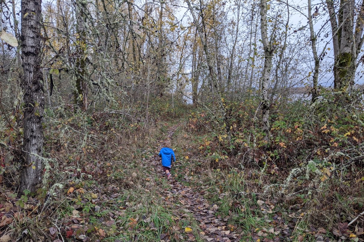
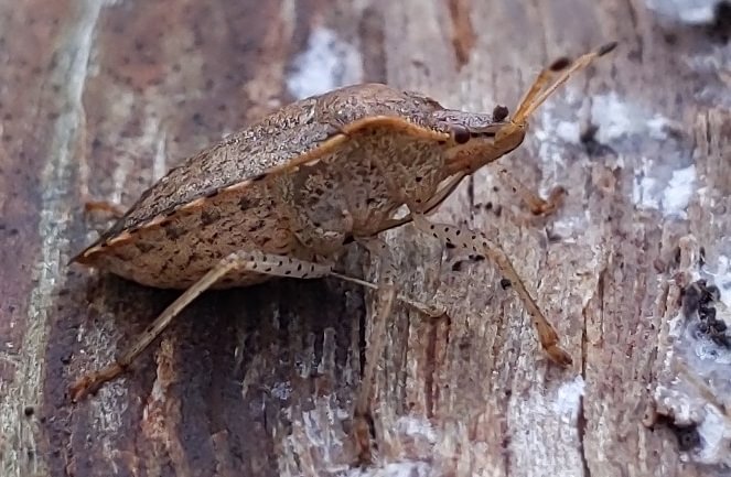
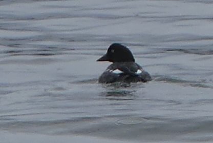
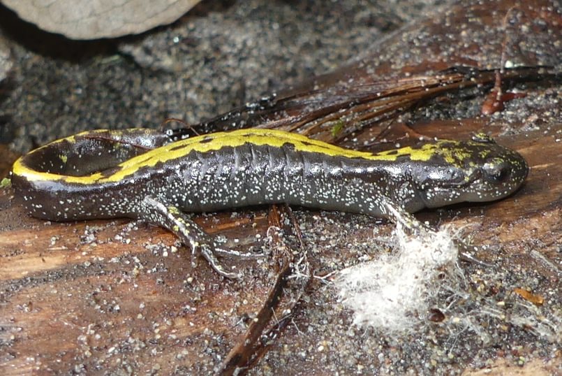
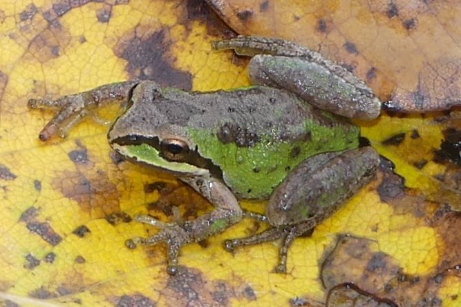
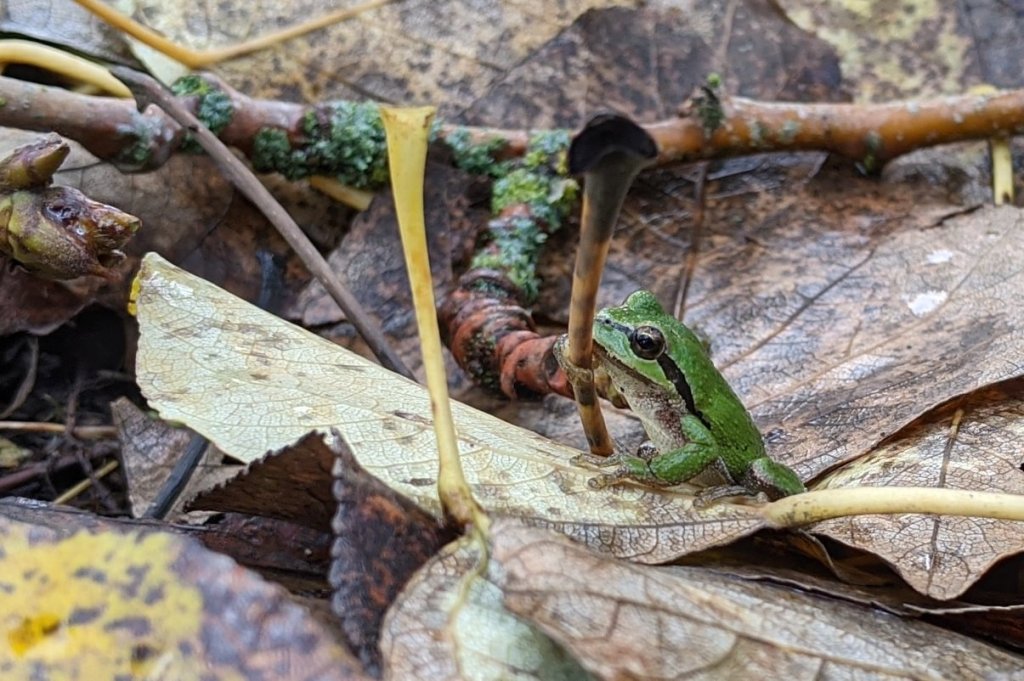
Birds were sparse, with a Common Goldeneye and a Cooper’s Hawk being the only sightings of note. Amphibians and mollusks were prevalent if you knew where to look, especially Western Long-toed Salamanders, Northern Pacific Treefrogs, and Reticulate Taildroppers.
After taking our time on Willow Bar Islands, we then headed up towards the north end to Warrior Point Trail. This path extends for 3.5 miles out to Warrior Rock, site of the island’s first interaction between White men and Native Americans.
“Lieutenant William Broughton was sent to survey the Columbia for the British Admiralty, and he reached the island. About 150 warriors arrived in 23 canoes when he landed on the rocks at the island’s northern end. Indians from another river tribe who accompanied Broughton explained his mission, and the islanders welcomed the men and stayed to trade. That night, the British explorers slept on the island. Broughton named the location Point Warrior and today’s name of Warrior Rock still bears the remembrance of the occasion.”
– The 1792 meeting between the British and the Multnomah as recounted at sauvieisland.org
Unfortunately our schedule meant we could only explore the first mile, which was broader and better established than the previous trail though otherwise similar in aura.
As we drove out I noticed a bird viewing platform (at milepost 7 on Reeder Road) and got out to take a look. I appreciated the platform’s setup, but the marshes beyond were empty outside of a lone Northern Harrier bobbing through the air.
Then just as I stepped away, the flocks came! Cranes, ducks, cackling geese, snow geese, their aerial wedges passing over en masse. I don’t know what signal had told the birds to fly over all at once, but here they were!
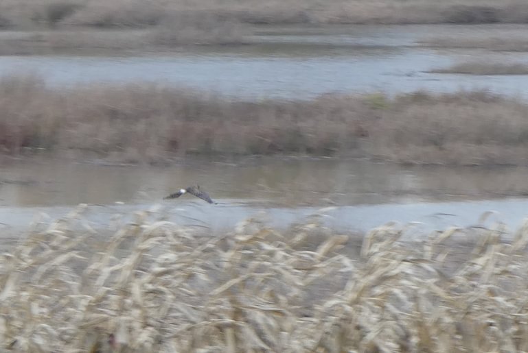
Northern Harrier 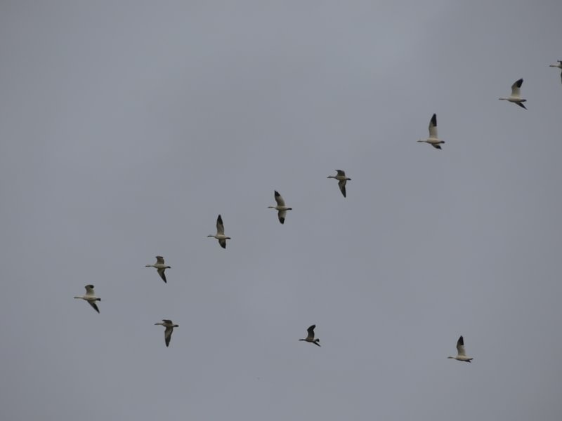
Snow Geese 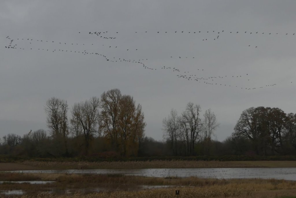
Everything!
The flocks were a parting gift, a reminder that though much has changed, the birds are still here. The 11,643 acres of preserved public land makes that possible.
Indeed, much has changed. It would be a disservice to the island if I ended without noting the center of that change.
Over two centuries ago, when men on canoes came out to meet Lieutenant William Broughton and when Lewis and Clark stopped to trade, Sauvie Island was more densely populated than it is today. Fifteen massive longhouses – each a village unto itself – were spread across the island, supporting a population of about 2,000 people. And up to 4 to 5 times that many men from the river’s surrounding villages would fill the island during harvests. These Multnomah tribes cultivated wapato, hunted elk, deer, and waterfowl, and fished the waters of their home. They built with the Western Red Cedar, dressed in cleaned animal skins and cedar bark, and decorated with the river’s shells.
Unfortunately, in the early 1800s these people were decimated by European diseases like smallpox and measles. Most devastating was a malaria epidemic that began sweeping across the area in 1829, killing 90% of those who had survived the previous plagues. Vulnerable in number and weakened by disease, the survivors were little match for the Hudson Bay Company, who stepped in to forcibly evict them from their homes and then burn down the longhouses, clearing the island for White settlement. A few years later the Company sent Laurent Sauvé to establish a dairy. Thus the island took on his name, starting a new history, erasing those who had made it their home first.
You can spend the whole day at Sauvie Island without noticing the slightest hint of the people who once used it best.
Willow Bar Islands Trail at a glance
What: hiking, river beach
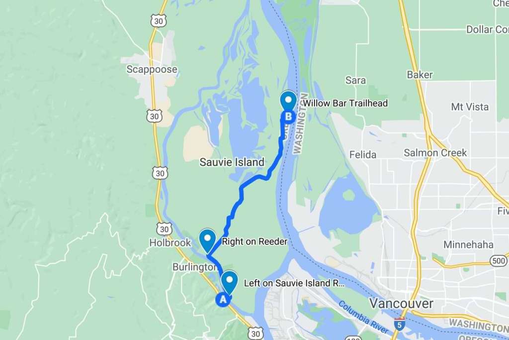
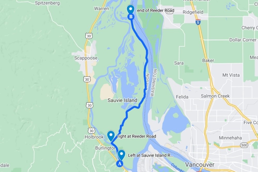
Where: From Highway 30, turn onto Sauvie Island Road to cross the Sauvie Island Bridge. Follow the road north two miles to Reeder Road. Drive down Reeder Road for 6.9 miles when you’ll reach a gravel road with signs for a trail. Go 0.3 miles to the parking lot at the end of the gravel road to reach the trailhead at 45.7309, -122.7676.
Hiking: The trail is 3 miles out and back.
Camping: none
Notable Wildlife: Columbia Blacktail Deer, Raccoon, sea lions, waterfowl, loons, grebes, wading birds, woodpeckers
Warrior Point Trail at a glance
What: hiking, birdwatching, berry picking
Where: From Highway 30, turn onto Sauvie Island Road to cross the Sauvie Island Bridge. Follow the road north two miles to turn right on Reeder Road. Stay on this road for 12.8 miles all the way to the end (the last 2.3 miles are gravel). Parking lot is at the end of the road at 45.8087, -122.7977.
Hiking: 7 miles out-and-back. See more detailed hiking information here.
Camping: none
Notable Wildlife: sea lions, Bald Eagle, Sandhill Crane, Tundra Swan, other waterfowl, loons, grebes, wading birds, shorebirds, gulls, woodpeckers, song birds
Property status: State of Oregon: Sauvie Island Wildlife Area
Website: Sauvie Island Community Association: Warrior Rock Lighthouse
